Pineville geodata
Pineville (Kentucky) is a seat of a second-order administrative division; located in United States in America/New_York (GMT-4) time zone. With population of 1,762 people, there are 12692 cities with bigger population in this country. Compared to other cities in United States, 67% of cities are located further ↑North; 60.1% of cities are located further ←West and 74.5% of cities have lower elevation than Pineville. Note1


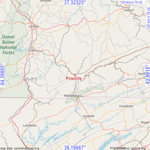
Pineville GPS coordinates[2]
36° 45' 43.308" North, 83° 41' 41.712" West
| Map corner | latitude | longitude |
|---|---|---|
| Upper-left | 37.32325°, | -84.39805° |
| Center: | 36.76203°, | -83.69492° |
| Lower-right: | 36.19667°, | -82.9918° |
| Map W x H: | 125.3×125.3 km | = 77.9×77.9mi |
| max Lat: | 71.29058° ⇑67% North |
| Pineville: | 36.76203° |
| min Lat: | ⇓33% South 19.06759° |
| min Long | Pineville | max Long |
| -171.73463° | -83.69492° | -66.98998° |
| W 60.1%⇐ | ⇒39.9% E |
Elevation
Elevation of Pineville is 310 m = 1017 ft, and this is 15.2 m = 50 ft above average elevation for this country.
| Max E: |
3189 m = 10463 ft | 25.5% |
| Pineville | 310 m 1017 ft | |
| Avg. | 294.8 m = 967 ft | |
Min E: |
-60 m = -197 ft | 74.5% |
See also: United States elevation on elevation.city.
Geographical zone
Pineville is located in North temperate zone (between Tropic of Cancer and the Arctic Circle). Distance of this Northern Tropic circle is 1481.6 km =920.6 mi to South.| Distance of | km | miles | from Pineville |
|---|---|---|---|
| North Pole | 5919.5 | 3678.2 | to North |
| Arctic Circle | 3313.6 | 2059 | to North |
| Tropic Cancer | 1481.6 | 920.6 | to South |
| Equator | 4087.6 | 2539.9 | to South |


Nearby cities:
15 places around Pineville: (largest is in red/bold)
• Artemus
15.3 km =9.5 mi,  301°
301°
• Barbourville
20.8 km =12.9 mi, 303°
• Cawood
41.6 km =25.8 mi,  86°
86°
• Corbin
41.3 km =25.7 mi, 300°
• Flat Lick
10 km =6.2 mi,  317°
317°
• Harlan
34.4 km =21.4 mi,  74°
74°
• Harrogate
20.3 km =12.6 mi,  170°
170°
• Loyall
32 km =19.9 mi, 71°
• Middlesboro
17.2 km =10.7 mi,  186°
186°
• New Tazewell
36.5 km =22.7 mi, 166°
• North Corbin
41.8 km =26 mi, 301°
• Rose Hill
30.9 km =19.2 mi,  108°
108°
• South Wallins
26 km =16.2 mi,  76°
76°
• Tazewell
36 km =22.4 mi,  161°
161°
• Williamsburg
41.5 km =25.8 mi,  267°
267°
Sources, notices
• [Note1] Compared only with cities in United States existing in our database
• [Src1] Map data: © OpenStreetMap contributors (CC-BY-SA)
• [Src2] Other city data from geonames.org with taken over terms of usage.
• [Src3] Geographical zone / Annual Mean Temperature by Robert A. Rohde @ Wikipedia
