Breaux Bridge geodata
Breaux Bridge (Louisiana) is a populated place; located in United States in America/Chicago (GMT-5) time zone. With population of 8,395 people, there are 5081 cities with bigger population in this country. Compared to other cities in United States, 92.6% of cities are located further ↑North; 63.9% of cities are located further →East and 93.9% of cities have higher elevation than Breaux Bridge. Note1


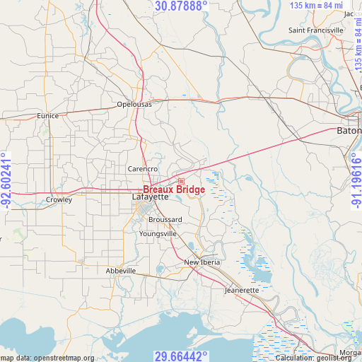
Breaux Bridge GPS coordinates[2]
30° 16' 24.708" North, 91° 53' 57.408" West
| Map corner | latitude | longitude |
|---|---|---|
| Upper-left | 30.87888°, | -92.60241° |
| Center: | 30.27353°, | -91.89928° |
| Lower-right: | 29.66442°, | -91.19616° |
| Map W x H: | 135×135 km | = 83.9×83.9mi |
| max Lat: | 71.29058° ⇑92.6% North |
| Breaux Bridge: | 30.27353° |
| min Lat: | ⇓7.4% South 19.06759° |
| min Long | Breaux Bridge | max Long |
| -171.73463° | -91.89928° | -66.98998° |
| W 36.1%⇐ | ⇒63.9% E |
Elevation
Elevation of Breaux Bridge is 10 m = 33 ft, and this is 284.8 m = 934 ft below average elevation for this country.
| Max E: |
3189 m = 10463 ft | 93.9% |
| Avg. | 294.8 m = 967 ft | |
| Breaux Bridge | 10 m = 33 ft | |
Min E: |
-60 m = -197 ft | 6.1% |
See also: United States elevation on elevation.city.
Geographical zone
Breaux Bridge is located in North temperate zone (between Tropic of Cancer and the Arctic Circle). Distance of this Northern Tropic circle is 760.2 km =472.4 mi to South.| Distance of | km | miles | from Breaux Bridge |
|---|---|---|---|
| North Pole | 6641 | 4126.5 | to North |
| Arctic Circle | 4035.1 | 2507.3 | to North |
| Tropic Cancer | 760.2 | 472.4 | to South |
| Equator | 3366.1 | 2091.6 | to South |


Nearby cities:
15 places around Breaux Bridge: (largest is in red/bold)
• Arnaudville
14.1 km =8.8 mi,  347°
347°
• Broussard
15.3 km =9.5 mi,  202°
202°
• Cade
20.7 km =12.9 mi,  181°
181°
• Carencro
15.2 km =9.4 mi,  288°
288°
• Catahoula
19.4 km =12.1 mi,  109°
109°
• Cecilia
8.3 km =5.2 mi,  32°
32°
• Grand Coteau
21.6 km =13.4 mi,  319°
319°
• Henderson
11.3 km =7 mi,  67°
67°
• Lafayette
12.8 km =8 mi,  244°
244°
• Ossun
20.5 km =12.7 mi,  270°
270°
• Parks
9.2 km =5.7 mi,  135°
135°
• Saint Martinville
17.7 km =11 mi,  159°
159°
• Scott
19.2 km =11.9 mi,  257°
257°
• Sunset
22.3 km =13.9 mi,  313°
313°
• Youngsville
21.2 km =13.2 mi, 204°
Sources, notices
• [Note1] Compared only with cities in United States existing in our database
• [Src1] Map data: © OpenStreetMap contributors (CC-BY-SA)
• [Src2] Other city data from geonames.org with taken over terms of usage.
• [Src3] Geographical zone / Annual Mean Temperature by Robert A. Rohde @ Wikipedia
