Bellefontaine Neighbors geodata
Bellefontaine Neighbors (Missouri) is a populated place; located in United States in America/Chicago (GMT-5) time zone. With population of 10,798 people, there are 4233 cities with bigger population in this country. Compared to other cities in United States, 57.1% of cities are located further ↑North; 59.8% of cities are located further →East and 62.7% of cities have higher elevation than Bellefontaine Neighbors. Note1
Administrative division(s):
- Level 1: Missouri
- Level 2: Saint Louis County
- Level 3: Township of Saint Ferdinand
Current local time in Bellefontaine Neighbors:
05:44 PM, SundayDifference from your time zone: hours


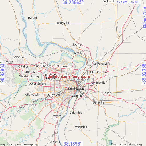
Bellefontaine Neighbors GPS coordinates[2]
38° 44' 25.188" North, 90° 13' 35.4" West
| Map corner | latitude | longitude |
|---|---|---|
| Upper-left | 39.28665°, | -90.92963° |
| Center: | 38.74033°, | -90.2265° |
| Lower-right: | 38.1898°, | -89.52338° |
| Map W x H: | 122×122 km | = 75.8×75.8mi |
| max Lat: | 71.29058° ⇑57.1% North |
| Bellefontaine Neighbors: | 38.74033° |
| min Lat: | ⇓42.9% South 19.06759° |
| min Long | Bellefontaine N | max Long |
| -171.73463° | -90.2265° | -66.98998° |
| W 40.2%⇐ | ⇒59.8% E |
Elevation
Elevation of Bellefontaine Neighbors is 140 m = 459 ft, and this is 154.8 m = 508 ft below average elevation for this country.
| Max E: |
3189 m = 10463 ft | 62.7% |
| Avg. | 294.8 m = 967 ft | |
| Bellefontaine Neighbors | 140 m = 459 ft | |
Min E: |
-60 m = -197 ft | 37.3% |
See also: United States elevation on elevation.city.
Geographical zone
Bellefontaine Neighbors is located in North temperate zone (between Tropic of Cancer and the Arctic Circle). Distance of this Northern Tropic circle is 1701.6 km =1057.3 mi to South.| Distance of | km | miles | from Bellefontaine Neighbors |
|---|---|---|---|
| North Pole | 5699.5 | 3541.5 | to North |
| Arctic Circle | 3093.7 | 1922.3 | to North |
| Tropic Cancer | 1701.6 | 1057.3 | to South |
| Equator | 4307.5 | 2676.6 | to South |


Nearby cities:
15 places around Bellefontaine Neighbors: (largest is in red/bold)
• Castle Point
2.7 km =1.7 mi,  316°
316°
• Country Club Hills
4.7 km =2.9 mi,  242°
242°
• Dellwood
5.2 km =3.2 mi,  281°
281°
• Ferguson
6.9 km =4.3 mi,  273°
273°
• Flordell Hills
4.2 km =2.6 mi,  233°
233°
• Glasgow Village
2.8 km =1.7 mi,  58°
58°
• Jennings
3.8 km =2.4 mi, 231°
• Moline Acres
1.4 km =0.9 mi,  302°
302°
• Normandy
6.5 km =4 mi,  250°
250°
• Northwoods
6.4 km =4 mi, 230°
• Norwood Court
6.2 km =3.9 mi, 246°
• Pasadena Hills
6.8 km =4.2 mi, 238°
• Pine Lawn
6.5 km =4 mi,  220°
220°
• Riverview
1.5 km =0.9 mi, 57°
• Spanish Lake
5.4 km =3.4 mi,  9°
9°
Sources, notices
• [Note1] Compared only with cities in United States existing in our database
• [Src1] Map data: © OpenStreetMap contributors (CC-BY-SA)
• [Src2] Other city data from geonames.org with taken over terms of usage.
• [Src3] Geographical zone / Annual Mean Temperature by Robert A. Rohde @ Wikipedia
