Edneyville geodata
Edneyville (North Carolina) is a populated place; located in United States in America/New_York (GMT-4) time zone. With population of 2,367 people, there are 10933 cities with bigger population in this country. Compared to other cities in United States, 73.2% of cities are located further ↑North; 64.5% of cities are located further ←West and 90.8% of cities have lower elevation than Edneyville. Note1
Administrative division(s):
- Level 1: North Carolina
- Level 2: Henderson County
- Level 3: Township of Edneyville


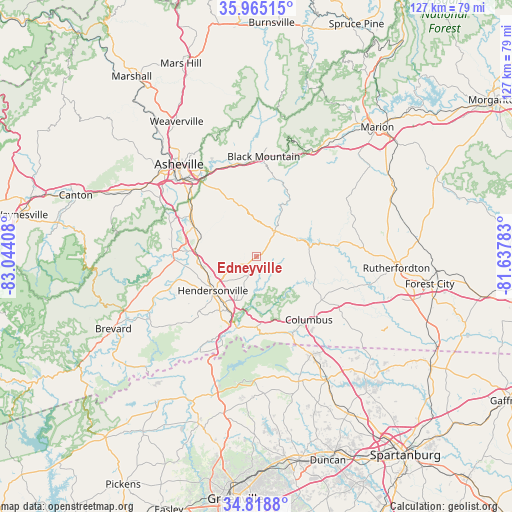
Edneyville GPS coordinates[2]
35° 23' 38.436" North, 82° 20' 27.42" West
| Map corner | latitude | longitude |
|---|---|---|
| Upper-left | 35.96515°, | -83.04408° |
| Center: | 35.39401°, | -82.34095° |
| Lower-right: | 34.8188°, | -81.63783° |
| Map W x H: | 127.5×127.5 km | = 79.2×79.2mi |
| max Lat: | 71.29058° ⇑73.2% North |
| Edneyville: | 35.39401° |
| min Lat: | ⇓26.8% South 19.06759° |
| min Long | Edneyville | max Long |
| -171.73463° | -82.34095° | -66.98998° |
| W 64.5%⇐ | ⇒35.5% E |
Elevation
Elevation of Edneyville is 684 m = 2244 ft, and this is 389.2 m = 1277 ft above average elevation for this country.
| Max E: |
3189 m = 10463 ft | 9.2% |
| Edneyville | 684 m 2244 ft | |
| Avg. | 294.8 m = 967 ft | |
Min E: |
-60 m = -197 ft | 90.8% |
See also: United States elevation on elevation.city.
Geographical zone
Edneyville is located in North temperate zone (between Tropic of Cancer and the Arctic Circle). Distance of this Northern Tropic circle is 1329.5 km =826.1 mi to South.| Distance of | km | miles | from Edneyville |
|---|---|---|---|
| North Pole | 6071.6 | 3772.7 | to North |
| Arctic Circle | 3465.7 | 2153.5 | to North |
| Tropic Cancer | 1329.5 | 826.1 | to South |
| Equator | 3935.4 | 2445.3 | to South |


Nearby cities:
15 places around Edneyville: (largest is in red/bold)
• Balfour
13 km =8.1 mi,  246°
246°
• Barker Heights
13.1 km =8.1 mi,  225°
225°
• Dana
7.8 km =4.8 mi,  203°
203°
• East Flat Rock
14.6 km =9.1 mi,  210°
210°
• Fairview
14.2 km =8.8 mi,  339°
339°
• Flat Rock
16.4 km =10.2 mi, 213°
• Fletcher
15.1 km =9.4 mi,  285°
285°
• Fruitland
4.7 km =2.9 mi,  273°
273°
• Hendersonville
13.7 km =8.5 mi, 232°
• Hoopers Creek
12.5 km =7.8 mi, 293°
• Lake Lure
12.9 km =8 mi,  73°
73°
• Laurel Park
16.5 km =10.3 mi,  237°
237°
• Mountain Home
14 km =8.7 mi,  258°
258°
• Saluda
17.6 km =10.9 mi,  182°
182°
• Valley Hill
16.7 km =10.4 mi, 230°
Sources, notices
• [Note1] Compared only with cities in United States existing in our database
• [Src1] Map data: © OpenStreetMap contributors (CC-BY-SA)
• [Src2] Other city data from geonames.org with taken over terms of usage.
• [Src3] Geographical zone / Annual Mean Temperature by Robert A. Rohde @ Wikipedia
