Haddonfield geodata
Haddonfield (New Jersey) is a populated place; located in United States in America/New_York (GMT-4) time zone. With population of 11,414 people, there are 4050 cities with bigger population in this country. Compared to other cities in United States, 52.4% of cities are located further ↓South; 87.2% of cities are located further ←West and 84.4% of cities have higher elevation than Haddonfield. Note1
Administrative division(s):
- Level 1: New Jersey
- Level 2: Camden County
- Level 3: Borough of Haddonfield


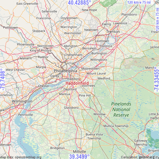
Haddonfield GPS coordinates[2]
39° 53' 29.4" North, 75° 2' 15.612" West
| Map corner | latitude | longitude |
|---|---|---|
| Upper-left | 40.42885°, | -75.7408° |
| Center: | 39.8915°, | -75.03767° |
| Lower-right: | 39.3499°, | -74.33455° |
| Map W x H: | 120×120 km | = 74.6×74.6mi |
| max Lat: | 71.29058° ⇑47.6% North |
| Haddonfield: | 39.8915° |
| min Lat: | ⇓52.4% South 19.06759° |
| min Long | Haddonfield | max Long |
| -171.73463° | -75.03767° | -66.98998° |
| W 87.2%⇐ | ⇒12.8% E |
Elevation
Elevation of Haddonfield is 30 m = 98 ft, and this is 264.8 m = 869 ft below average elevation for this country.
| Max E: |
3189 m = 10463 ft | 84.4% |
| Avg. | 294.8 m = 967 ft | |
| Haddonfield | 30 m = 98 ft | |
Min E: |
-60 m = -197 ft | 15.6% |
See also: United States elevation on elevation.city.
Geographical zone
Haddonfield is located in North temperate zone (between Tropic of Cancer and the Arctic Circle). Distance of this Northern Tropic circle is 1829.6 km =1136.9 mi to South.| Distance of | km | miles | from Haddonfield |
|---|---|---|---|
| North Pole | 5571.5 | 3462 | to North |
| Arctic Circle | 2965.7 | 1842.8 | to North |
| Tropic Cancer | 1829.6 | 1136.9 | to South |
| Equator | 4435.5 | 2756.1 | to South |


Nearby cities:
15 places around Haddonfield: (largest is in red/bold)
• Ashland
4.2 km =2.6 mi,  139°
139°
• Audubon
3 km =1.9 mi,  268°
268°
• Audubon Park
4.3 km =2.7 mi,  277°
277°
• Barrington
3.3 km =2.1 mi,  206°
206°
• Brookfield
2.1 km =1.3 mi,  117°
117°
• Cherry Hill
4.9 km =3 mi,  7°
7°
• Collingswood
4.1 km =2.5 mi,  315°
315°
• Ellisburg
3.4 km =2.1 mi,  43°
43°
• Golden Triangle
4 km =2.5 mi,  358°
358°
• Haddon Heights
2.8 km =1.7 mi,  235°
235°
• Lawnside
2.9 km =1.8 mi,  163°
163°
• Magnolia
4.1 km =2.5 mi,  181°
181°
• Mount Ephraim
4.9 km =3 mi,  252°
252°
• Oaklyn
4.1 km =2.5 mi, 284°
• Runnemede
5.1 km =3.2 mi, 210°
Sources, notices
• [Note1] Compared only with cities in United States existing in our database
• [Src1] Map data: © OpenStreetMap contributors (CC-BY-SA)
• [Src2] Other city data from geonames.org with taken over terms of usage.
• [Src3] Geographical zone / Annual Mean Temperature by Robert A. Rohde @ Wikipedia
