Port Republic geodata
Port Republic (New Jersey) is a populated place; located in United States in America/New_York (GMT-4) time zone. With population of 1,100 people, there are 15674 cities with bigger population in this country. Compared to other cities in United States, 50.7% of cities are located further ↑North; 88.6% of cities are located further ←West and 94.8% of cities have higher elevation than Port Republic. Note1
Administrative division(s):
- Level 1: New Jersey
- Level 2: Atlantic County
- Level 3: City of Port Republic


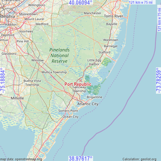
Port Republic GPS coordinates[2]
39° 31' 14.412" North, 74° 29' 8.556" West
| Map corner | latitude | longitude |
|---|---|---|
| Upper-left | 40.06094°, | -75.18884° |
| Center: | 39.52067°, | -74.48571° |
| Lower-right: | 38.97617°, | -73.78259° |
| Map W x H: | 120.6×120.6 km | = 74.9×74.9mi |
| max Lat: | 71.29058° ⇑50.7% North |
| Port Republic: | 39.52067° |
| min Lat: | ⇓49.3% South 19.06759° |
| min Long | Port Republic | max Long |
| -171.73463° | -74.48571° | -66.98998° |
| W 88.6%⇐ | ⇒11.4% E |
Elevation
Elevation of Port Republic is 9 m = 30 ft, and this is 285.8 m = 938 ft below average elevation for this country.
| Max E: |
3189 m = 10463 ft | 94.8% |
| Avg. | 294.8 m = 967 ft | |
| Port Republic | 9 m = 30 ft | |
Min E: |
-60 m = -197 ft | 5.2% |
See also: United States elevation on elevation.city.
Geographical zone
Port Republic is located in North temperate zone (between Tropic of Cancer and the Arctic Circle). Distance of this Northern Tropic circle is 1788.4 km =1111.3 mi to South.| Distance of | km | miles | from Port Republic |
|---|---|---|---|
| North Pole | 5612.8 | 3487.6 | to North |
| Arctic Circle | 3006.9 | 1868.4 | to North |
| Tropic Cancer | 1788.4 | 1111.3 | to South |
| Equator | 4394.3 | 2730.5 | to South |


Nearby cities:
15 places around Port Republic: (largest is in red/bold)
• Absecon
10.3 km =6.4 mi,  184°
184°
• Atlantic City
18.2 km =11.3 mi,  162°
162°
• Beach Haven
21.2 km =13.2 mi,  78°
78°
• Brigantine
16.1 km =10 mi,  139°
139°
• Egg Harbor City
13.9 km =8.6 mi,  273°
273°
• Elwood
20.8 km =12.9 mi,  287°
287°
• Linwood
21.5 km =13.4 mi,  200°
200°
• Margate City
21.5 km =13.4 mi, 184°
• Mystic Island
9.2 km =5.7 mi,  73°
73°
• Northfield
17.6 km =10.9 mi, 198°
• Pleasantville
14.9 km =9.3 mi,  192°
192°
• Pomona
9 km =5.6 mi,  238°
238°
• Smithville
3.8 km =2.4 mi, 140°
• Tuckerton
15.5 km =9.6 mi,  53°
53°
• Ventnor City
20.1 km =12.5 mi, 177°
Sources, notices
• [Note1] Compared only with cities in United States existing in our database
• [Src1] Map data: © OpenStreetMap contributors (CC-BY-SA)
• [Src2] Other city data from geonames.org with taken over terms of usage.
• [Src3] Geographical zone / Annual Mean Temperature by Robert A. Rohde @ Wikipedia
