The Village of Indian Hill geodata
The Village of Indian Hill (Ohio) is a populated place; located in United States in America/New_York (GMT-4) time zone. With population of 5,798 people, there are 6539 cities with bigger population in this country. Compared to other cities in United States, 53.2% of cities are located further ↑North; 58.1% of cities are located further ←West and 62.4% of cities have lower elevation than The Village of Indian Hill. Note1
Current local time in The Village of Indian Hill:
12:43 AM, MondayDifference from your time zone: hours


The Village of Indian Hill GPS coordinates[2]
39° 10' 46.164" North, 84° 20' 6.612" West
| Map corner | latitude | longitude |
|---|---|---|
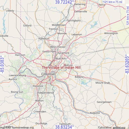
| Upper-left | 39.72242°, | -85.0383° |
| Center: | 39.17949°, | -84.33517° |
| Lower-right: | 38.63234°, | -83.63205° |
| Map W x H: | 121.2×121.2 km | = 75.3×75.3mi |
| max Lat: | 71.29058° ⇑53.2% North |
| The Village of Indian Hill: | 39.17949° |
| min Lat: | ⇓46.8% South 19.06759° |
| min Long | The Village of | max Long |
| -171.73463° | -84.33517° | -66.98998° |
| W 58.1%⇐ | ⇒41.9% E |
Elevation
Elevation of The Village of Indian Hill is 250 m = 820 ft, and this is 44.8 m = 147 ft below average elevation for this country.
| Max E: |
3189 m = 10463 ft | 37.6% |
| Avg. | 294.8 m = 967 ft | |
| The Village of Indian Hill | 250 m = 820 ft | |
Min E: |
-60 m = -197 ft | 62.4% |
See also: United States elevation on elevation.city.
Geographical zone
The Village of Indian Hill is located in North temperate zone (between Tropic of Cancer and the Arctic Circle). Distance of this Northern Tropic circle is 1750.4 km =1087.6 mi to South.| Distance of | km | miles | from The Village of Indian Hill |
|---|---|---|---|
| North Pole | 5650.7 | 3511.2 | to North |
| Arctic Circle | 3044.8 | 1892 | to North |
| Tropic Cancer | 1750.4 | 1087.6 | to South |
| Equator | 4356.4 | 2706.9 | to South |


Nearby cities:
15 places around The Village of Indian Hill: (largest is in red/bold)
• Blue Ash
6.9 km =4.3 mi,  327°
327°
• Concorde Hills
3.9 km =2.4 mi, 331°
• Deer Park
5.9 km =3.7 mi,  299°
299°
• Dillonvale
7.2 km =4.5 mi,  306°
306°
• Fairfax
6.3 km =3.9 mi,  232°
232°
• Kenwood
4.4 km =2.7 mi,  321°
321°
• Madeira
2.8 km =1.7 mi, 297°
• Mariemont
5.1 km =3.2 mi,  221°
221°
• Milford
3.5 km =2.2 mi,  97°
97°
• Montgomery
5.6 km =3.5 mi,  343°
343°
• Mulberry
8.2 km =5.1 mi,  79°
79°
• Newtown
6.5 km =4 mi,  200°
200°
• Rossmoyne
5.9 km =3.7 mi, 310°
• Silverton
5.8 km =3.6 mi,  284°
284°
• Terrace Park
3.3 km =2.1 mi,  133°
133°
Sources, notices
• [Note1] Compared only with cities in United States existing in our database
• [Src1] Map data: © OpenStreetMap contributors (CC-BY-SA)
• [Src2] Other city data from geonames.org with taken over terms of usage.
• [Src3] Geographical zone / Annual Mean Temperature by Robert A. Rohde @ Wikipedia
