Cochranville geodata
Cochranville (Pennsylvania) is a populated place; located in United States in America/New_York (GMT-4) time zone. With population of 668 people, there are 18991 cities with bigger population in this country. Compared to other cities in United States, 52.4% of cities are located further ↓South; 84.3% of cities are located further ←West and 55.1% of cities have higher elevation than Cochranville. Note1
Administrative division(s):
- Level 1: Pennsylvania
- Level 2: Chester County
- Level 3: Township of West Fallowfield


Cochranville GPS coordinates[2]
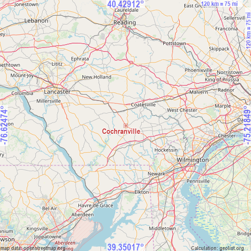
39° 53' 30.372" North, 75° 55' 17.796" West
| Map corner | latitude | longitude |
|---|---|---|
| Upper-left | 40.42912°, | -76.62474° |
| Center: | 39.89177°, | -75.92161° |
| Lower-right: | 39.35017°, | -75.21849° |
| Map W x H: | 120×120 km | = 74.6×74.6mi |
| max Lat: | 71.29058° ⇑47.6% North |
| Cochranville: | 39.89177° |
| min Lat: | ⇓52.4% South 19.06759° |
| min Long | Cochranville | max Long |
| -171.73463° | -75.92161° | -66.98998° |
| W 84.3%⇐ | ⇒15.7% E |
Elevation
Elevation of Cochranville is 180 m = 591 ft, and this is 114.8 m = 377 ft below average elevation for this country.
| Max E: |
3189 m = 10463 ft | 55.1% |
| Avg. | 294.8 m = 967 ft | |
| Cochranville | 180 m = 591 ft | |
Min E: |
-60 m = -197 ft | 44.9% |
See also: United States elevation on elevation.city.
Geographical zone
Cochranville is located in North temperate zone (between Tropic of Cancer and the Arctic Circle). Distance of this Northern Tropic circle is 1829.6 km =1136.9 mi to South.| Distance of | km | miles | from Cochranville |
|---|---|---|---|
| North Pole | 5571.5 | 3462 | to North |
| Arctic Circle | 2965.6 | 1842.7 | to North |
| Tropic Cancer | 1829.6 | 1136.9 | to South |
| Equator | 4435.5 | 2756.1 | to South |


Nearby cities:
15 places around Cochranville: (largest is in red/bold)
• Atglen
7.8 km =4.8 mi,  325°
325°
• Avondale
14 km =8.7 mi,  122°
122°
• Caln
16.3 km =10.1 mi,  47°
47°
• Christiana
9.5 km =5.9 mi,  317°
317°
• Coatesville
13.1 km =8.1 mi,  39°
39°
• Gap
13.6 km =8.5 mi, 321°
• Georgetown
14.7 km =9.1 mi,  290°
290°
• Modena
13 km =8.1 mi, 52°
• Oxford
12.8 km =8 mi,  202°
202°
• Parkesburg
7.4 km =4.6 mi,  1°
1°
• South Coatesville
12.6 km =7.8 mi, 43°
• Toughkenamon
15.5 km =9.6 mi, 115°
• Upland
12.6 km =7.8 mi,  92°
92°
• West Grove
11.2 km =7 mi,  133°
133°
• Westwood
10.6 km =6.6 mi,  33°
33°
Sources, notices
• [Note1] Compared only with cities in United States existing in our database
• [Src1] Map data: © OpenStreetMap contributors (CC-BY-SA)
• [Src2] Other city data from geonames.org with taken over terms of usage.
• [Src3] Geographical zone / Annual Mean Temperature by Robert A. Rohde @ Wikipedia
