Greenville geodata
Greenville (South Carolina) is a seat of a second-order administrative division; located in United States in America/New_York (GMT-4) time zone. With population of 64,579 people, there are 672 cities with bigger population in this country. Compared to other cities in United States, 76.2% of cities are located further ↑North; 64.3% of cities are located further ←West and 74% of cities have lower elevation than Greenville. Note1


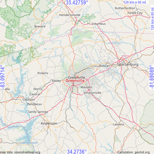
Greenville GPS coordinates[2]
34° 51' 9.432" North, 82° 23' 38.436" West
| Map corner | latitude | longitude |
|---|---|---|
| Upper-left | 35.42759°, | -83.09714° |
| Center: | 34.85262°, | -82.39401° |
| Lower-right: | 34.2736°, | -81.69089° |
| Map W x H: | 128.3×128.3 km | = 79.7×79.7mi |
| max Lat: | 71.29058° ⇑76.2% North |
| Greenville: | 34.85262° |
| min Lat: | ⇓23.8% South 19.06759° |
| min Long | Greenville | max Long |
| -171.73463° | -82.39401° | -66.98998° |
| W 64.3%⇐ | ⇒35.7% E |
Elevation
Elevation of Greenville is 307 m = 1007 ft, and this is 12.2 m = 40 ft above average elevation for this country.
| Max E: |
3189 m = 10463 ft | 26% |
| Greenville | 307 m 1007 ft | |
| Avg. | 294.8 m = 967 ft | |
Min E: |
-60 m = -197 ft | 74% |
See also: Greenville elevation on elevation.city.
Geographical zone
Greenville is located in North temperate zone (between Tropic of Cancer and the Arctic Circle). Distance of this Northern Tropic circle is 1269.3 km =788.7 mi to South.| Distance of | km | miles | from Greenville |
|---|---|---|---|
| North Pole | 6131.8 | 3810.1 | to North |
| Arctic Circle | 3525.9 | 2190.9 | to North |
| Tropic Cancer | 1269.3 | 788.7 | to South |
| Equator | 3875.2 | 2407.9 | to South |


Nearby cities:
15 places around Greenville: (largest is in red/bold)
• Berea
6.7 km =4.2 mi,  302°
302°
• City View
3.6 km =2.2 mi,  286°
286°
• Dunean
3.9 km =2.4 mi,  216°
216°
• Five Forks
15.9 km =9.9 mi,  109°
109°
• Gantt
6.5 km =4 mi,  205°
205°
• Golden Grove
13.9 km =8.6 mi,  198°
198°
• Judson
3.8 km =2.4 mi,  234°
234°
• Mauldin
11.2 km =7 mi,  137°
137°
• Parker
5.4 km =3.4 mi,  267°
267°
• Powdersville
11.3 km =7 mi, 233°
• Sans Souci
3.9 km =2.4 mi,  315°
315°
• Taylors
11.7 km =7.3 mi,  49°
49°
• Travelers Rest
13.6 km =8.5 mi,  340°
340°
• Wade Hampton
7.9 km =4.9 mi,  44°
44°
• Welcome
5 km =3.1 mi, 234°
Sources, notices
• [Note1] Compared only with cities in United States existing in our database
• [Src1] Map data: © OpenStreetMap contributors (CC-BY-SA)
• [Src2] Other city data from geonames.org with taken over terms of usage.
• [Src3] Geographical zone / Annual Mean Temperature by Robert A. Rohde @ Wikipedia
