West Pelzer geodata
West Pelzer (South Carolina) is a populated place; located in United States in America/New_York (GMT-4) time zone. With population of 906 people, there are 16942 cities with bigger population in this country. Compared to other cities in United States, 77.1% of cities are located further ↑North; 64% of cities are located further ←West and 64.1% of cities have lower elevation than West Pelzer. Note1


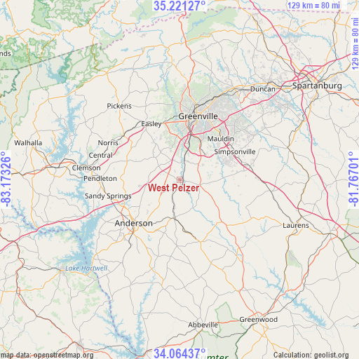
West Pelzer GPS coordinates[2]
34° 38' 41.424" North, 82° 28' 12.468" West
| Map corner | latitude | longitude |
|---|---|---|
| Upper-left | 35.22127°, | -83.17326° |
| Center: | 34.64484°, | -82.47013° |
| Lower-right: | 34.06437°, | -81.76701° |
| Map W x H: | 128.6×128.6 km | = 79.9×79.9mi |
| max Lat: | 71.29058° ⇑77.1% North |
| West Pelzer: | 34.64484° |
| min Lat: | ⇓22.9% South 19.06759° |
| min Long | West Pelzer | max Long |
| -171.73463° | -82.47013° | -66.98998° |
| W 64%⇐ | ⇒36% E |
Elevation
Elevation of West Pelzer is 258 m = 846 ft, and this is 36.8 m = 121 ft below average elevation for this country.
| Max E: |
3189 m = 10463 ft | 35.9% |
| Avg. | 294.8 m = 967 ft | |
| West Pelzer | 258 m = 846 ft | |
Min E: |
-60 m = -197 ft | 64.1% |
See also: United States elevation on elevation.city.
Geographical zone
West Pelzer is located in North temperate zone (between Tropic of Cancer and the Arctic Circle). Distance of this Northern Tropic circle is 1246.2 km =774.4 mi to South.| Distance of | km | miles | from West Pelzer |
|---|---|---|---|
| North Pole | 6154.9 | 3824.5 | to North |
| Arctic Circle | 3549 | 2205.2 | to North |
| Tropic Cancer | 1246.2 | 774.4 | to South |
| Equator | 3852.1 | 2393.6 | to South |


Nearby cities:
15 places around West Pelzer: (largest is in red/bold)
• Anderson
22.8 km =14.2 mi,  226°
226°
• Belton
13.7 km =8.5 mi,  189°
189°
• Dunean
20.5 km =12.7 mi,  13°
13°
• Gantt
17.8 km =11.1 mi, 13°
• Golden Grove
10.2 km =6.3 mi, 13°
• Honea Path
23.2 km =14.4 mi,  161°
161°
• Judson
21.3 km =13.2 mi, 10°
• Mauldin
20.9 km =13 mi,  44°
44°
• Northlake
21.4 km =13.3 mi,  245°
245°
• Parker
22.9 km =14.2 mi,  3°
3°
• Piedmont
6.4 km =4 mi, 4°
• Powdersville
16.5 km =10.3 mi,  352°
352°
• Simpsonville
22.2 km =13.8 mi,  62°
62°
• Welcome
20.4 km =12.7 mi, 8°
• Williamston
3 km =1.9 mi, 193°
Sources, notices
• [Note1] Compared only with cities in United States existing in our database
• [Src1] Map data: © OpenStreetMap contributors (CC-BY-SA)
• [Src2] Other city data from geonames.org with taken over terms of usage.
• [Src3] Geographical zone / Annual Mean Temperature by Robert A. Rohde @ Wikipedia
