Fayetteville geodata
Fayetteville (West Virginia) is a seat of a second-order administrative division; located in United States in America/New_York (GMT-4) time zone. With population of 2,892 people, there are 9818 cities with bigger population in this country. Compared to other cities in United States, 61.3% of cities are located further ↑North; 69.2% of cities are located further ←West and 88.9% of cities have lower elevation than Fayetteville. Note1


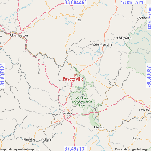
Fayetteville GPS coordinates[2]
38° 3' 10.404" North, 81° 6' 14.364" West
| Map corner | latitude | longitude |
|---|---|---|
| Upper-left | 38.60446°, | -81.80712° |
| Center: | 38.05289°, | -81.10399° |
| Lower-right: | 37.49713°, | -80.40087° |
| Map W x H: | 123.1×123.1 km | = 76.5×76.5mi |
| max Lat: | 71.29058° ⇑61.3% North |
| Fayetteville: | 38.05289° |
| min Lat: | ⇓38.7% South 19.06759° |
| min Long | Fayetteville | max Long |
| -171.73463° | -81.10399° | -66.98998° |
| W 69.2%⇐ | ⇒30.8% E |
Elevation
Elevation of Fayetteville is 551 m = 1808 ft, and this is 256.2 m = 841 ft above average elevation for this country.
| Max E: |
3189 m = 10463 ft | 11.1% |
| Fayetteville | 551 m 1808 ft | |
| Avg. | 294.8 m = 967 ft | |
Min E: |
-60 m = -197 ft | 88.9% |
See also: United States elevation on elevation.city.
Geographical zone
Fayetteville is located in North temperate zone (between Tropic of Cancer and the Arctic Circle). Distance of this Northern Tropic circle is 1625.2 km =1009.9 mi to South.| Distance of | km | miles | from Fayetteville |
|---|---|---|---|
| North Pole | 5776 | 3589 | to North |
| Arctic Circle | 3170.1 | 1969.8 | to North |
| Tropic Cancer | 1625.2 | 1009.9 | to South |
| Equator | 4231.1 | 2629.1 | to South |


Nearby cities:
15 places around Fayetteville: (largest is in red/bold)
• Ansted
9.3 km =5.8 mi,  2°
2°
• Boomer
19.4 km =12.1 mi,  304°
304°
• Bradley
22.3 km =13.9 mi,  200°
200°
• Gauley Bridge
15.1 km =9.4 mi,  328°
328°
• Hilltop
12.9 km =8 mi, 198°
• Montgomery
24.2 km =15 mi,  305°
305°
• Mount Hope
18.3 km =11.4 mi, 196°
• Oak Hill
9.8 km =6.1 mi, 203°
• Piney View
24.2 km =15 mi,  186°
186°
• Powellton
19.9 km =12.4 mi,  284°
284°
• Pratt
30.1 km =18.7 mi, 305°
• Prosperity
25.5 km =15.8 mi, 199°
• Rainelle
31 km =19.3 mi,  107°
107°
• Smithers
22.8 km =14.2 mi, 308°
• Stanaford
26.7 km =16.6 mi, 189°
Sources, notices
• [Note1] Compared only with cities in United States existing in our database
• [Src1] Map data: © OpenStreetMap contributors (CC-BY-SA)
• [Src2] Other city data from geonames.org with taken over terms of usage.
• [Src3] Geographical zone / Annual Mean Temperature by Robert A. Rohde @ Wikipedia
