Indian Head Park geodata
Indian Head Park (Illinois) is a populated place; located in United States in America/Chicago (GMT-5) time zone. With population of 3,824 people, there are 8429 cities with bigger population in this country. Compared to other cities in United States, 73.6% of cities are located further ↓South; 52.4% of cities are located further →East and 51.2% of cities have lower elevation than Indian Head Park. Note1


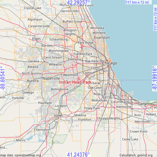
Indian Head Park GPS coordinates[2]
41° 46' 13.116" North, 87° 54' 8.208" West
| Map corner | latitude | longitude |
|---|---|---|
| Upper-left | 42.29257°, | -88.60541° |
| Center: | 41.77031°, | -87.90228° |
| Lower-right: | 41.24376°, | -87.19916° |
| Map W x H: | 116.6×116.6 km | = 72.5×72.5mi |
| max Lat: | 71.29058° ⇑26.4% North |
| Indian Head Park: | 41.77031° |
| min Lat: | ⇓73.6% South 19.06759° |
| min Long | Indian Head Par | max Long |
| -171.73463° | -87.90228° | -66.98998° |
| W 47.6%⇐ | ⇒52.4% E |
Elevation
Elevation of Indian Head Park is 203 m = 666 ft, and this is 91.8 m = 301 ft below average elevation for this country.
| Max E: |
3189 m = 10463 ft | 48.8% |
| Avg. | 294.8 m = 967 ft | |
| Indian Head Park | 203 m = 666 ft | |
Min E: |
-60 m = -197 ft | 51.2% |
See also: United States elevation on elevation.city.
Geographical zone
Indian Head Park is located in North temperate zone (between Tropic of Cancer and the Arctic Circle). Distance of this Northern Tropic circle is 2038.5 km =1266.7 mi to South.| Distance of | km | miles | from Indian Head Park |
|---|---|---|---|
| North Pole | 5362.6 | 3332.2 | to North |
| Arctic Circle | 2756.8 | 1713 | to North |
| Tropic Cancer | 2038.5 | 1266.7 | to South |
| Equator | 4644.4 | 2885.9 | to South |


Nearby cities:
15 places around Indian Head Park: (largest is in red/bold)
• Brookfield
7.3 km =4.5 mi,  35°
35°
• Burr Ridge
2.7 km =1.7 mi,  209°
209°
• Clarendon Hills
5.3 km =3.3 mi,  304°
304°
• Countryside
2.4 km =1.5 mi,  55°
55°
• Darien
6.3 km =3.9 mi,  251°
251°
• Hinsdale
4.5 km =2.8 mi,  319°
319°
• Hodgkins
3.7 km =2.3 mi,  92°
92°
• Justice
6.1 km =3.8 mi,  118°
118°
• La Grange
4.7 km =2.9 mi, 35°
• La Grange Park
7.9 km =4.9 mi,  25°
25°
• Oak Brook
7.3 km =4.5 mi,  342°
342°
• Western Springs
4.4 km =2.7 mi,  1°
1°
• Westmont
6.7 km =4.2 mi, 295°
• Willow Springs
4.8 km =3 mi,  133°
133°
• Willowbrook
2.8 km =1.7 mi,  268°
268°
Sources, notices
• [Note1] Compared only with cities in United States existing in our database
• [Src1] Map data: © OpenStreetMap contributors (CC-BY-SA)
• [Src2] Other city data from geonames.org with taken over terms of usage.
• [Src3] Geographical zone / Annual Mean Temperature by Robert A. Rohde @ Wikipedia
