Hodgdon geodata
Hodgdon (Maine) is a populated place; located in United States in America/New_York (GMT-4) time zone. With population of 1,289 people, there are 14644 cities with bigger population in this country. Compared to other cities in United States, 95.1% of cities are located further ↓South; 99.9% of cities are located further ←West and 64.4% of cities have higher elevation than Hodgdon. Note1


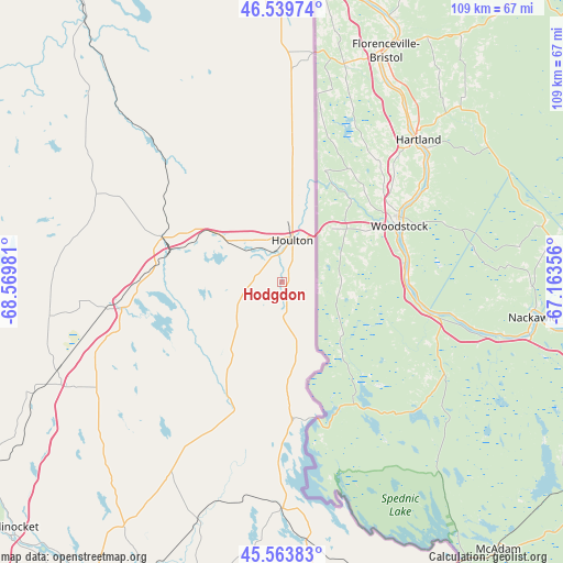
Hodgdon GPS coordinates[2]
46° 3' 14.184" North, 67° 52' 0.048" West
| Map corner | latitude | longitude |
|---|---|---|
| Upper-left | 46.53974°, | -68.56981° |
| Center: | 46.05394°, | -67.86668° |
| Lower-right: | 45.56383°, | -67.16356° |
| Map W x H: | 108.5×108.5 km | = 67.4×67.4mi |
| max Lat: | 71.29058° ⇑4.9% North |
| Hodgdon: | 46.05394° |
| min Lat: | ⇓95.1% South 19.06759° |
| min Long | Hodgdon | max Long |
| -171.73463° | -67.86668° | -66.98998° |
| W 99.9%⇐ | ⇒0.099999999999994% E |
Elevation
Elevation of Hodgdon is 131 m = 430 ft, and this is 163.8 m = 537 ft below average elevation for this country.
| Max E: |
3189 m = 10463 ft | 64.4% |
| Avg. | 294.8 m = 967 ft | |
| Hodgdon | 131 m = 430 ft | |
Min E: |
-60 m = -197 ft | 35.6% |
See also: United States elevation on elevation.city.
Geographical zone
Hodgdon is located in North temperate zone (between Tropic of Cancer and the Arctic Circle). Distance of this North polar circle is 2280.5 km =1417 mi to North.| Distance of | km | miles | from Hodgdon |
|---|---|---|---|
| North Pole | 4886.3 | 3036.2 | to North |
| Arctic Circle | 2280.5 | 1417 | to North |
| Tropic Cancer | 2514.8 | 1562.6 | to South |
| Equator | 5120.7 | 3181.9 | to South |


Nearby cities:
15 places around Hodgdon: (largest is in red/bold)
• Bridgewater
41.6 km =25.8 mi,  2°
2°
• Danforth
43.8 km =27.2 mi,  180°
180°
• Easton
65.4 km =40.6 mi,  357°
357°
• Houlton
8.3 km =5.2 mi,  14°
14°
• Island Falls
31.6 km =19.6 mi,  260°
260°
• Linneus
7.4 km =4.6 mi, 256°
• Littleton
19.8 km =12.3 mi, 5°
• Mars Hill
51.4 km =31.9 mi, 0°
• Monticello
28.4 km =17.6 mi, 3°
• New Limerick
8.9 km =5.5 mi,  306°
306°
• Oakfield
22.4 km =13.9 mi,  282°
282°
• Patten
45.2 km =28.1 mi, 261°
• Presque Isle
70.7 km =43.9 mi,  350°
350°
• Sherman
47.2 km =29.3 mi,  244°
244°
• Westfield
57.6 km =35.8 mi, 355°
Sources, notices
• [Note1] Compared only with cities in United States existing in our database
• [Src1] Map data: © OpenStreetMap contributors (CC-BY-SA)
• [Src2] Other city data from geonames.org with taken over terms of usage.
• [Src3] Geographical zone / Annual Mean Temperature by Robert A. Rohde @ Wikipedia
