Topsham geodata
Topsham (Maine) is a populated place; located in United States in America/New_York (GMT-4) time zone. With population of 5,931 people, there are 6449 cities with bigger population in this country. Compared to other cities in United States, 88.1% of cities are located further ↓South; 98.9% of cities are located further ←West and 79.9% of cities have higher elevation than Topsham. Note1


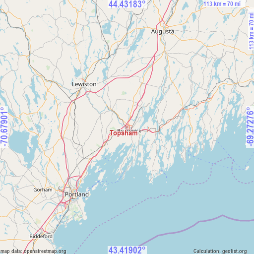
Topsham GPS coordinates[2]
43° 55' 39.288" North, 69° 58' 33.168" West
| Map corner | latitude | longitude |
|---|---|---|
| Upper-left | 44.43183°, | -70.67901° |
| Center: | 43.92758°, | -69.97588° |
| Lower-right: | 43.41902°, | -69.27276° |
| Map W x H: | 112.6×112.6 km | = 70×70mi |
| max Lat: | 71.29058° ⇑11.9% North |
| Topsham: | 43.92758° |
| min Lat: | ⇓88.1% South 19.06759° |
| min Long | Topsham | max Long |
| -171.73463° | -69.97588° | -66.98998° |
| W 98.9%⇐ | ⇒1.1% E |
Elevation
Elevation of Topsham is 47 m = 154 ft, and this is 247.8 m = 813 ft below average elevation for this country.
| Max E: |
3189 m = 10463 ft | 79.9% |
| Avg. | 294.8 m = 967 ft | |
| Topsham | 47 m = 154 ft | |
Min E: |
-60 m = -197 ft | 20.1% |
See also: United States elevation on elevation.city.
Geographical zone
Topsham is located in North temperate zone (between Tropic of Cancer and the Arctic Circle). Distance of this Northern Tropic circle is 2278.4 km =1415.7 mi to South.| Distance of | km | miles | from Topsham |
|---|---|---|---|
| North Pole | 5122.8 | 3183.2 | to North |
| Arctic Circle | 2516.9 | 1563.9 | to North |
| Tropic Cancer | 2278.4 | 1415.7 | to South |
| Equator | 4884.3 | 3035 | to South |


Nearby cities:
15 places around Topsham: (largest is in red/bold)
• Bath
12.6 km =7.8 mi,  98°
98°
• Bowdoinham
11.1 km =6.9 mi,  34°
34°
• Brunswick
1.7 km =1.1 mi,  149°
149°
• Brunswick Station
5.7 km =3.5 mi,  142°
142°
• Freeport
12.9 km =8 mi,  232°
232°
• Harpswell Center
14 km =8.7 mi,  182°
182°
• Lisbon
15.5 km =9.6 mi,  318°
318°
• Lisbon Falls
10.2 km =6.3 mi, 318°
• North Bath
12.8 km =8 mi,  86°
86°
• Phippsburg
17.6 km =10.9 mi,  132°
132°
• Richmond
22.7 km =14.1 mi,  38°
38°
• Sabattus
23.8 km =14.8 mi,  333°
333°
• Westport
21.7 km =13.5 mi, 98°
• Woolwich
14 km =8.7 mi, 94°
• Yarmouth
22 km =13.7 mi, 230°
Sources, notices
• [Note1] Compared only with cities in United States existing in our database
• [Src1] Map data: © OpenStreetMap contributors (CC-BY-SA)
• [Src2] Other city data from geonames.org with taken over terms of usage.
• [Src3] Geographical zone / Annual Mean Temperature by Robert A. Rohde @ Wikipedia
