Vassalboro geodata
Vassalboro (Maine) is a populated place; located in United States in America/New_York (GMT-4) time zone. With population of 4,208 people, there are 7973 cities with bigger population in this country. Compared to other cities in United States, 90.3% of cities are located further ↓South; 99.1% of cities are located further ←West and 78.4% of cities have higher elevation than Vassalboro. Note1


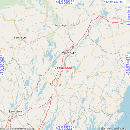
Vassalboro GPS coordinates[2]
44° 27' 33.228" North, 69° 40' 39.18" West
| Map corner | latitude | longitude |
|---|---|---|
| Upper-left | 44.95893°, | -70.38068° |
| Center: | 44.45923°, | -69.67755° |
| Lower-right: | 43.95522°, | -68.97443° |
| Map W x H: | 111.6×111.6 km | = 69.3×69.3mi |
| max Lat: | 71.29058° ⇑9.7% North |
| Vassalboro: | 44.45923° |
| min Lat: | ⇓90.3% South 19.06759° |
| min Long | Vassalboro | max Long |
| -171.73463° | -69.67755° | -66.98998° |
| W 99.1%⇐ | ⇒0.90000000000001% E |
Elevation
Elevation of Vassalboro is 54 m = 177 ft, and this is 240.8 m = 790 ft below average elevation for this country.
| Max E: |
3189 m = 10463 ft | 78.4% |
| Avg. | 294.8 m = 967 ft | |
| Vassalboro | 54 m = 177 ft | |
Min E: |
-60 m = -197 ft | 21.6% |
See also: United States elevation on elevation.city.
Geographical zone
Vassalboro is located in North temperate zone (between Tropic of Cancer and the Arctic Circle). Distance of this Northern Tropic circle is 2337.5 km =1452.5 mi to South.| Distance of | km | miles | from Vassalboro |
|---|---|---|---|
| North Pole | 5063.7 | 3146.4 | to North |
| Arctic Circle | 2457.8 | 1527.2 | to North |
| Tropic Cancer | 2337.5 | 1452.5 | to South |
| Equator | 4943.4 | 3071.7 | to South |


Nearby cities:
15 places around Vassalboro: (largest is in red/bold)
• Albion
20.3 km =12.6 mi,  66°
66°
• Augusta
18.4 km =11.4 mi,  206°
206°
• Belgrade
12.4 km =7.7 mi,  263°
263°
• Benton
17.3 km =10.7 mi,  35°
35°
• China
12.9 km =8 mi,  80°
80°
• Fairfield
15.7 km =9.8 mi,  23°
23°
• Hallowell
21.3 km =13.2 mi, 205°
• Manchester
20.9 km =13 mi,  224°
224°
• Oakland
9.7 km =6 mi,  338°
338°
• Palermo
17.1 km =10.6 mi,  109°
109°
• Rome
20.7 km =12.9 mi,  312°
312°
• Sidney
6.6 km =4.1 mi, 218°
• Waterville
10.9 km =6.8 mi, 19°
• Windsor
18.2 km =11.3 mi,  155°
155°
• Winslow
10.7 km =6.6 mi, 24°
Sources, notices
• [Note1] Compared only with cities in United States existing in our database
• [Src1] Map data: © OpenStreetMap contributors (CC-BY-SA)
• [Src2] Other city data from geonames.org with taken over terms of usage.
• [Src3] Geographical zone / Annual Mean Temperature by Robert A. Rohde @ Wikipedia
