Ubly geodata
Ubly (Michigan) is a populated place; located in United States in America/Detroit (GMT-4) time zone. With population of 828 people, there are 17532 cities with bigger population in this country. Compared to other cities in United States, 87.3% of cities are located further ↓South; 62.2% of cities are located further ←West and 60.3% of cities have lower elevation than Ubly. Note1


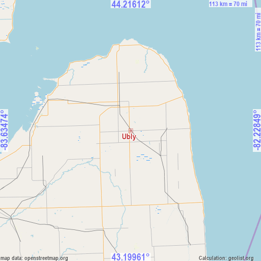
Ubly GPS coordinates[2]
43° 42' 36.072" North, 82° 55' 53.796" West
| Map corner | latitude | longitude |
|---|---|---|
| Upper-left | 44.21612°, | -83.63474° |
| Center: | 43.71002°, | -82.93161° |
| Lower-right: | 43.19961°, | -82.22849° |
| Map W x H: | 113×113 km | = 70.2×70.2mi |
| max Lat: | 71.29058° ⇑12.7% North |
| Ubly: | 43.71002° |
| min Lat: | ⇓87.3% South 19.06759° |
| min Long | Ubly | max Long |
| -171.73463° | -82.93161° | -66.98998° |
| W 62.2%⇐ | ⇒37.8% E |
Elevation
Elevation of Ubly is 241 m = 791 ft, and this is 53.8 m = 177 ft below average elevation for this country.
| Max E: |
3189 m = 10463 ft | 39.7% |
| Avg. | 294.8 m = 967 ft | |
| Ubly | 241 m = 791 ft | |
Min E: |
-60 m = -197 ft | 60.3% |
See also: United States elevation on elevation.city.
Geographical zone
Ubly is located in North temperate zone (between Tropic of Cancer and the Arctic Circle). Distance of this Northern Tropic circle is 2254.2 km =1400.7 mi to South.| Distance of | km | miles | from Ubly |
|---|---|---|---|
| North Pole | 5147 | 3198.2 | to North |
| Arctic Circle | 2541.1 | 1579 | to North |
| Tropic Cancer | 2254.2 | 1400.7 | to South |
| Equator | 4860.1 | 3019.9 | to South |


Nearby cities:
15 places around Ubly: (largest is in red/bold)
• Bad Axe
11.6 km =7.2 mi,  331°
331°
• Caro
44.8 km =27.8 mi,  237°
237°
• Carsonville
37.8 km =23.5 mi,  146°
146°
• Caseville
37.5 km =23.3 mi,  313°
313°
• Cass City
23 km =14.3 mi, 238°
• Deckerville
25.8 km =16 mi,  142°
142°
• Elkton
23.4 km =14.5 mi,  301°
301°
• Harbor Beach
27 km =16.8 mi,  56°
56°
• Kilmanagh
34.6 km =21.5 mi,  278°
278°
• Marlette
44.2 km =27.5 mi,  195°
195°
• Pigeon
30.3 km =18.8 mi, 296°
• Port Austin
37.7 km =23.4 mi,  352°
352°
• Port Sanilac
44.1 km =27.4 mi,  134°
134°
• Sandusky
33.2 km =20.6 mi,  165°
165°
• Sebewaing
41.8 km =26 mi,  273°
273°
Sources, notices
• [Note1] Compared only with cities in United States existing in our database
• [Src1] Map data: © OpenStreetMap contributors (CC-BY-SA)
• [Src2] Other city data from geonames.org with taken over terms of usage.
• [Src3] Geographical zone / Annual Mean Temperature by Robert A. Rohde @ Wikipedia
