Manchester geodata
Manchester (New Hampshire) is a populated place; located in United States in America/New_York (GMT-4) time zone. With population of 110,229 people, there are 304 cities with bigger population in this country. Compared to other cities in United States, 83.2% of cities are located further ↓South; 96.7% of cities are located further ←West and 73.3% of cities have higher elevation than Manchester. Note1
Administrative division(s):
- Level 1: New Hampshire
- Level 2: Hillsborough County
- Level 3: City of Manchester


Manchester GPS coordinates[2]
42° 59' 44.304" North, 71° 27' 17.244" West
| Map corner | latitude | longitude |
|---|---|---|
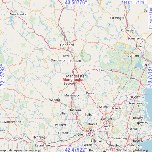
| Upper-left | 43.50776°, | -72.15792° |
| Center: | 42.99564°, | -71.45479° |
| Lower-right: | 42.47922°, | -70.75167° |
| Map W x H: | 114.4×114.4 km | = 71.1×71.1mi |
| max Lat: | 71.29058° ⇑16.8% North |
| Manchester: | 42.99564° |
| min Lat: | ⇓83.2% South 19.06759° |
| min Long | Manchester | max Long |
| -171.73463° | -71.45479° | -66.98998° |
| W 96.7%⇐ | ⇒3.3% E |
Elevation
Elevation of Manchester is 81 m = 266 ft, and this is 213.8 m = 701 ft below average elevation for this country.
| Max E: |
3189 m = 10463 ft | 73.3% |
| Avg. | 294.8 m = 967 ft | |
| Manchester | 81 m = 266 ft | |
Min E: |
-60 m = -197 ft | 26.7% |
See also: Manchester elevation on elevation.city.
Geographical zone
Manchester is located in North temperate zone (between Tropic of Cancer and the Arctic Circle). Distance of this Northern Tropic circle is 2174.7 km =1351.3 mi to South.| Distance of | km | miles | from Manchester |
|---|---|---|---|
| North Pole | 5226.4 | 3247.5 | to North |
| Arctic Circle | 2620.5 | 1628.3 | to North |
| Tropic Cancer | 2174.7 | 1351.3 | to South |
| Equator | 4780.7 | 2970.6 | to South |


Nearby cities:
15 places around Manchester: (largest is in red/bold)
• Auburn
8.7 km =5.4 mi,  83°
83°
• Bedford
7.4 km =4.6 mi,  222°
222°
• Bow Bog
14.6 km =9.1 mi,  341°
341°
• Chester
16.6 km =10.3 mi,  105°
105°
• Derry
16.5 km =10.3 mi,  140°
140°
• Derry Village
16.4 km =10.2 mi,  134°
134°
• East Merrimack
14.4 km =8.9 mi,  189°
189°
• Goffstown
12.2 km =7.6 mi,  283°
283°
• Hooksett
11.3 km =7 mi,  355°
355°
• Londonderry
15.9 km =9.9 mi,  155°
155°
• Merrimack
14.9 km =9.3 mi, 192°
• Pembroke
16.8 km =10.4 mi, 359°
• Pinardville
4.3 km =2.7 mi,  267°
267°
• South Hooksett
3.8 km =2.4 mi,  24°
24°
• Suncook
15 km =9.3 mi,  0°
0°
Sources, notices
• [Note1] Compared only with cities in United States existing in our database
• [Src1] Map data: © OpenStreetMap contributors (CC-BY-SA)
• [Src2] Other city data from geonames.org with taken over terms of usage.
• [Src3] Geographical zone / Annual Mean Temperature by Robert A. Rohde @ Wikipedia
