Unity geodata
Unity (New Hampshire) is a populated place; located in United States in America/New_York (GMT-4) time zone. With population of 1,630 people, there are 13172 cities with bigger population in this country. Compared to other cities in United States, 85.3% of cities are located further ↓South; 95.3% of cities are located further ←West and 86.2% of cities have lower elevation than Unity. Note1


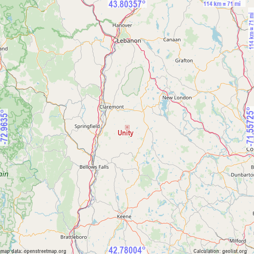
Unity GPS coordinates[2]
43° 17' 38.256" North, 72° 15' 37.332" West
| Map corner | latitude | longitude |
|---|---|---|
| Upper-left | 43.80357°, | -72.9635° |
| Center: | 43.29396°, | -72.26037° |
| Lower-right: | 42.78004°, | -71.55725° |
| Map W x H: | 113.8×113.8 km | = 70.7×70.7mi |
| max Lat: | 71.29058° ⇑14.7% North |
| Unity: | 43.29396° |
| min Lat: | ⇓85.3% South 19.06759° |
| min Long | Unity | max Long |
| -171.73463° | -72.26037° | -66.98998° |
| W 95.3%⇐ | ⇒4.7% E |
Elevation
Elevation of Unity is 448 m = 1470 ft, and this is 153.2 m = 503 ft above average elevation for this country.
| Max E: |
3189 m = 10463 ft | 13.8% |
| Unity | 448 m 1470 ft | |
| Avg. | 294.8 m = 967 ft | |
Min E: |
-60 m = -197 ft | 86.2% |
See also: United States elevation on elevation.city.
Geographical zone
Unity is located in North temperate zone (between Tropic of Cancer and the Arctic Circle). Distance of this Northern Tropic circle is 2207.9 km =1371.9 mi to South.| Distance of | km | miles | from Unity |
|---|---|---|---|
| North Pole | 5193.2 | 3226.9 | to North |
| Arctic Circle | 2587.3 | 1607.7 | to North |
| Tropic Cancer | 2207.9 | 1371.9 | to South |
| Equator | 4813.8 | 2991.2 | to South |


Nearby cities:
15 places around Unity: (largest is in red/bold)
• Acworth
8.8 km =5.5 mi,  196°
196°
• Alstead
18.1 km =11.2 mi,  206°
206°
• Ascutney
17.3 km =10.7 mi,  316°
316°
• Charlestown
14.6 km =9.1 mi,  245°
245°
• Claremont
11.6 km =7.2 mi, 322°
• Croydon
19.1 km =11.9 mi,  24°
24°
• Goshen
9.1 km =5.7 mi,  84°
84°
• Langdon
17.1 km =10.6 mi, 214°
• Lempster
7.4 km =4.6 mi,  146°
146°
• Marlow
20.5 km =12.7 mi,  165°
165°
• Newbury
18.4 km =11.4 mi, 80°
• Newport
10.6 km =6.6 mi,  41°
41°
• Springfield
18 km =11.2 mi,  271°
271°
• Sunapee
17.4 km =10.8 mi,  53°
53°
• Washington
18.7 km =11.6 mi,  134°
134°
Sources, notices
• [Note1] Compared only with cities in United States existing in our database
• [Src1] Map data: © OpenStreetMap contributors (CC-BY-SA)
• [Src2] Other city data from geonames.org with taken over terms of usage.
• [Src3] Geographical zone / Annual Mean Temperature by Robert A. Rohde @ Wikipedia
