Avon-by-the-Sea geodata
Avon-by-the-Sea (New Jersey) is a populated place; located in United States in America/New_York (GMT-4) time zone. With population of 1,794 people, there are 12560 cities with bigger population in this country. Compared to other cities in United States, 55.5% of cities are located further ↓South; 90.5% of cities are located further ←West and 97.4% of cities have higher elevation than Avon-by-the-Sea. Note1
Administrative division(s):
- Level 1: New Jersey
- Level 2: Monmouth County
- Level 3: Borough of Avon-by-the-Sea


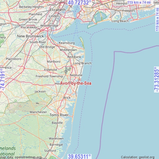
Avon-by-the-Sea GPS coordinates[2]
40° 11' 32.424" North, 74° 0' 57.492" West
| Map corner | latitude | longitude |
|---|---|---|
| Upper-left | 40.72732°, | -74.7191° |
| Center: | 40.19234°, | -74.01597° |
| Lower-right: | 39.65311°, | -73.31285° |
| Map W x H: | 119.4×119.4 km | = 74.2×74.2mi |
| max Lat: | 71.29058° ⇑44.5% North |
| Avon-by-the-Sea: | 40.19234° |
| min Lat: | ⇓55.5% South 19.06759° |
| min Long | Avon-by-the-Sea | max Long |
| -171.73463° | -74.01597° | -66.98998° |
| W 90.5%⇐ | ⇒9.5% E |
Elevation
Elevation of Avon-by-the-Sea is 6 m = 20 ft, and this is 288.8 m = 948 ft below average elevation for this country.
| Max E: |
3189 m = 10463 ft | 97.4% |
| Avg. | 294.8 m = 967 ft | |
| Avon-by-the-Sea | 6 m = 20 ft | |
Min E: |
-60 m = -197 ft | 2.6% |
See also: United States elevation on elevation.city.
Geographical zone
Avon-by-the-Sea is located in North temperate zone (between Tropic of Cancer and the Arctic Circle). Distance of this Northern Tropic circle is 1863.1 km =1157.7 mi to South.| Distance of | km | miles | from Avon-by-the-Sea |
|---|---|---|---|
| North Pole | 5538.1 | 3441.2 | to North |
| Arctic Circle | 2932.2 | 1822 | to North |
| Tropic Cancer | 1863.1 | 1157.7 | to South |
| Equator | 4469 | 2776.9 | to South |


Nearby cities:
15 places around Avon-by-the-Sea: (largest is in red/bold)
• Asbury Park
3.1 km =1.9 mi,  6°
6°
• Belmar
1.6 km =1 mi,  197°
197°
• Bradley Beach
1.2 km =0.7 mi,  16°
16°
• Deal
5.8 km =3.6 mi, 12°
• Interlaken
4.6 km =2.9 mi,  0°
0°
• Lake Como
3.8 km =2.4 mi, 196°
• Neptune City
1.3 km =0.8 mi,  310°
310°
• Ocean Grove
2.3 km =1.4 mi, 20°
• Sea Girt
6.9 km =4.3 mi,  193°
193°
• Shark River Hills
2.8 km =1.7 mi,  273°
273°
• South Belmar
2.6 km =1.6 mi, 202°
• Spring Lake
4.4 km =2.7 mi, 193°
• Spring Lake Heights
4.8 km =3 mi, 195°
• Wanamassa
4.5 km =2.8 mi,  349°
349°
• West Belmar
3.1 km =1.9 mi,  212°
212°
Sources, notices
• [Note1] Compared only with cities in United States existing in our database
• [Src1] Map data: © OpenStreetMap contributors (CC-BY-SA)
• [Src2] Other city data from geonames.org with taken over terms of usage.
• [Src3] Geographical zone / Annual Mean Temperature by Robert A. Rohde @ Wikipedia
