Linden geodata
Linden (New Jersey) is a populated place; located in United States in America/New_York (GMT-4) time zone. With population of 42,021 people, there are 1140 cities with bigger population in this country. Compared to other cities in United States, 60.4% of cities are located further ↓South; 89.3% of cities are located further ←West and 97.4% of cities have higher elevation than Linden. Note1


Linden GPS coordinates[2]
40° 37' 19.38" North, 74° 14' 40.524" West
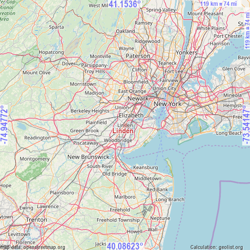
| Map corner | latitude | longitude |
|---|---|---|
| Upper-left | 41.1536°, | -74.94772° |
| Center: | 40.62205°, | -74.24459° |
| Lower-right: | 40.08623°, | -73.54147° |
| Map W x H: | 118.7×118.7 km | = 73.8×73.8mi |
| max Lat: | 71.29058° ⇑39.6% North |
| Linden: | 40.62205° |
| min Lat: | ⇓60.4% South 19.06759° |
| min Long | Linden | max Long |
| -171.73463° | -74.24459° | -66.98998° |
| W 89.3%⇐ | ⇒10.7% E |
Elevation
Elevation of Linden is 6 m = 20 ft, and this is 288.8 m = 948 ft below average elevation for this country.
| Max E: |
3189 m = 10463 ft | 97.4% |
| Avg. | 294.8 m = 967 ft | |
| Linden | 6 m = 20 ft | |
Min E: |
-60 m = -197 ft | 2.6% |
See also: Linden elevation on elevation.city.
Geographical zone
Linden is located in North temperate zone (between Tropic of Cancer and the Arctic Circle). Distance of this Northern Tropic circle is 1910.8 km =1187.3 mi to South.| Distance of | km | miles | from Linden |
|---|---|---|---|
| North Pole | 5490.3 | 3411.5 | to North |
| Arctic Circle | 2884.4 | 1792.3 | to North |
| Tropic Cancer | 1910.8 | 1187.3 | to South |
| Equator | 4516.7 | 2806.5 | to South |


Nearby cities:
15 places around Linden: (largest is in red/bold)
• Avenel
5.8 km =3.6 mi,  216°
216°
• Bloomfield
5.7 km =3.5 mi,  100°
100°
• Carteret
5.2 km =3.2 mi,  164°
164°
• Chelsea
4.8 km =3 mi,  119°
119°
• Clark
6 km =3.7 mi,  290°
290°
• Colonia
7.2 km =4.5 mi, 222°
• Cranford
6.2 km =3.9 mi,  311°
311°
• Elizabeth
5.5 km =3.4 mi,  31°
31°
• Kenilworth
7.2 km =4.5 mi,  327°
327°
• Mariners Harbor
7.4 km =4.6 mi,  77°
77°
• Port Reading
6.4 km =4 mi,  191°
191°
• Rahway
3.2 km =2 mi,  241°
241°
• Roselle
3.6 km =2.2 mi,  340°
340°
• Roselle Park
5 km =3.1 mi, 340°
• Winfield
4.1 km =2.5 mi,  303°
303°
Sources, notices
• [Note1] Compared only with cities in United States existing in our database
• [Src1] Map data: © OpenStreetMap contributors (CC-BY-SA)
• [Src2] Other city data from geonames.org with taken over terms of usage.
• [Src3] Geographical zone / Annual Mean Temperature by Robert A. Rohde @ Wikipedia
