Shrewsbury geodata
Shrewsbury (New Jersey) is a populated place; located in United States in America/New_York (GMT-4) time zone. With population of 3,809 people, there are 8446 cities with bigger population in this country. Compared to other cities in United States, 55.4% of cities are located further ↓South; 88.5% of cities are located further ←West and 80.9% of cities have higher elevation than Shrewsbury. Note1
Administrative division(s):
- Level 1: New Jersey
- Level 2: Monmouth County
- Level 3: Township of Upper Freehold


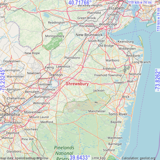
Shrewsbury GPS coordinates[2]
40° 10' 57.396" North, 74° 31' 45.552" West
| Map corner | latitude | longitude |
|---|---|---|
| Upper-left | 40.71766°, | -75.23245° |
| Center: | 40.18261°, | -74.52932° |
| Lower-right: | 39.6433°, | -73.8262° |
| Map W x H: | 119.5×119.5 km | = 74.3×74.3mi |
| max Lat: | 71.29058° ⇑44.6% North |
| Shrewsbury: | 40.18261° |
| min Lat: | ⇓55.4% South 19.06759° |
| min Long | Shrewsbury | max Long |
| -171.73463° | -74.52932° | -66.98998° |
| W 88.5%⇐ | ⇒11.5% E |
Elevation
Elevation of Shrewsbury is 43 m = 141 ft, and this is 251.8 m = 826 ft below average elevation for this country.
| Max E: |
3189 m = 10463 ft | 80.9% |
| Avg. | 294.8 m = 967 ft | |
| Shrewsbury | 43 m = 141 ft | |
Min E: |
-60 m = -197 ft | 19.1% |
See also: United States elevation on elevation.city.
Geographical zone
Shrewsbury is located in North temperate zone (between Tropic of Cancer and the Arctic Circle). Distance of this Northern Tropic circle is 1862 km =1157 mi to South.| Distance of | km | miles | from Shrewsbury |
|---|---|---|---|
| North Pole | 5539.2 | 3441.9 | to North |
| Arctic Circle | 2933.3 | 1822.7 | to North |
| Tropic Cancer | 1862 | 1157 | to South |
| Equator | 4467.9 | 2776.2 | to South |


Nearby cities:
15 places around Shrewsbury: (largest is in red/bold)
• Allentown
4.6 km =2.9 mi,  263°
263°
• Clearbrook Park
15.2 km =9.4 mi,  21°
21°
• Concordia
15.8 km =9.8 mi,  25°
25°
• Cranbury
14.9 km =9.3 mi,  5°
5°
• Groveville
12.2 km =7.6 mi, 263°
• Hamilton Square
11.6 km =7.2 mi,  295°
295°
• Hightstown
9.7 km =6 mi,  3°
3°
• Mercerville
14.7 km =9.1 mi,  294°
294°
• Mercerville-Hamilton Square
13.3 km =8.3 mi, 294°
• New Egypt
12.8 km =8 mi,  180°
180°
• Robbinsville
8.4 km =5.2 mi, 294°
• Roosevelt
6.3 km =3.9 mi,  48°
48°
• Twin Rivers
9.6 km =6 mi, 19°
• White Horse
14.7 km =9.1 mi,  273°
273°
• Yardville
11.5 km =7.1 mi, 269°
Sources, notices
• [Note1] Compared only with cities in United States existing in our database
• [Src1] Map data: © OpenStreetMap contributors (CC-BY-SA)
• [Src2] Other city data from geonames.org with taken over terms of usage.
• [Src3] Geographical zone / Annual Mean Temperature by Robert A. Rohde @ Wikipedia
