Augusta geodata
Augusta (New York) is a populated place; located in United States in America/New_York (GMT-4) time zone. With population of 2,041 people, there are 11824 cities with bigger population in this country. Compared to other cities in United States, 83.1% of cities are located further ↓South; 85.6% of cities are located further ←West and 70.9% of cities have lower elevation than Augusta. Note1


Augusta GPS coordinates[2]
42° 58' 29.244" North, 75° 30' 4.644" West
| Map corner | latitude | longitude |
|---|---|---|
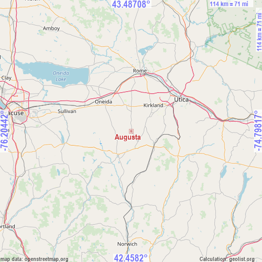
| Upper-left | 43.48708°, | -76.20442° |
| Center: | 42.97479°, | -75.50129° |
| Lower-right: | 42.4582°, | -74.79817° |
| Map W x H: | 114.4×114.4 km | = 71.1×71.1mi |
| max Lat: | 71.29058° ⇑16.9% North |
| Augusta: | 42.97479° |
| min Lat: | ⇓83.1% South 19.06759° |
| min Long | Augusta | max Long |
| -171.73463° | -75.50129° | -66.98998° |
| W 85.6%⇐ | ⇒14.4% E |
Elevation
Elevation of Augusta is 290 m = 951 ft, and this is 4.8 m = 16 ft below average elevation for this country.
| Max E: |
3189 m = 10463 ft | 29.1% |
| Avg. | 294.8 m = 967 ft | |
| Augusta | 290 m = 951 ft | |
Min E: |
-60 m = -197 ft | 70.9% |
See also: United States elevation on elevation.city.
Geographical zone
Augusta is located in North temperate zone (between Tropic of Cancer and the Arctic Circle). Distance of this Northern Tropic circle is 2172.4 km =1349.9 mi to South.| Distance of | km | miles | from Augusta |
|---|---|---|---|
| North Pole | 5228.7 | 3249 | to North |
| Arctic Circle | 2622.8 | 1629.7 | to North |
| Tropic Cancer | 2172.4 | 1349.9 | to South |
| Equator | 4778.3 | 2969.1 | to South |


Nearby cities:
15 places around Augusta: (largest is in red/bold)
• Chadwicks
19.6 km =12.2 mi,  72°
72°
• Clark Mills
16.4 km =10.2 mi,  37°
37°
• Clinton
12.9 km =8 mi,  50°
50°
• Hamilton
16.8 km =10.4 mi,  192°
192°
• Morrisville
14.1 km =8.8 mi,  233°
233°
• New Hartford
20.5 km =12.7 mi,  57°
57°
• Oneida
17.9 km =11.1 mi,  317°
317°
• Oneida Castle
16.1 km =10 mi, 318°
• Oriskany Falls
5.1 km =3.2 mi,  140°
140°
• Sherrill
13.5 km =8.4 mi, 324°
• Vernon
12 km =7.5 mi,  345°
345°
• Verona
19 km =11.8 mi,  342°
342°
• Wampsville
20.1 km =12.5 mi,  303°
303°
• Washington Mills
20.4 km =12.7 mi, 65°
• Waterville
11 km =6.8 mi,  116°
116°
Sources, notices
• [Note1] Compared only with cities in United States existing in our database
• [Src1] Map data: © OpenStreetMap contributors (CC-BY-SA)
• [Src2] Other city data from geonames.org with taken over terms of usage.
• [Src3] Geographical zone / Annual Mean Temperature by Robert A. Rohde @ Wikipedia
