Croton-on-Hudson geodata
Croton-on-Hudson (New York) is a populated place; located in United States in America/New_York (GMT-4) time zone. With population of 8,269 people, there are 5156 cities with bigger population in this country. Compared to other cities in United States, 67.9% of cities are located further ↓South; 91.2% of cities are located further ←West and 78.8% of cities have higher elevation than Croton-on-Hudson. Note1
Administrative division(s):
- Level 1: New York
- Level 2: Westchester County
- Level 3: Town of Cortlandt


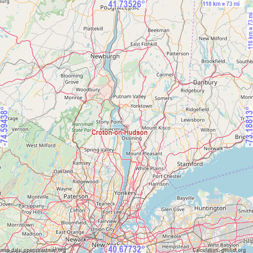
Croton-on-Hudson GPS coordinates[2]
41° 12' 30.348" North, 73° 53' 28.5" West
| Map corner | latitude | longitude |
|---|---|---|
| Upper-left | 41.73526°, | -74.59438° |
| Center: | 41.20843°, | -73.89125° |
| Lower-right: | 40.67732°, | -73.18813° |
| Map W x H: | 117.6×117.6 km | = 73.1×73.1mi |
| max Lat: | 71.29058° ⇑32.1% North |
| Croton-on-Hudson: | 41.20843° |
| min Lat: | ⇓67.9% South 19.06759° |
| min Long | Croton-on-Hudso | max Long |
| -171.73463° | -73.89125° | -66.98998° |
| W 91.2%⇐ | ⇒8.8% E |
Elevation
Elevation of Croton-on-Hudson is 52 m = 171 ft, and this is 242.8 m = 797 ft below average elevation for this country.
| Max E: |
3189 m = 10463 ft | 78.8% |
| Avg. | 294.8 m = 967 ft | |
| Croton-on-Hudson | 52 m = 171 ft | |
Min E: |
-60 m = -197 ft | 21.2% |
See also: United States elevation on elevation.city.
Geographical zone
Croton-on-Hudson is located in North temperate zone (between Tropic of Cancer and the Arctic Circle). Distance of this Northern Tropic circle is 1976 km =1227.8 mi to South.| Distance of | km | miles | from Croton-on-Hudson |
|---|---|---|---|
| North Pole | 5425.1 | 3371 | to North |
| Arctic Circle | 2819.2 | 1751.8 | to North |
| Tropic Cancer | 1976 | 1227.8 | to South |
| Equator | 4581.9 | 2847.1 | to South |


Nearby cities:
15 places around Croton-on-Hudson: (largest is in red/bold)
• Briarcliff Manor
9 km =5.6 mi,  141°
141°
• Buchanan
7.1 km =4.4 mi,  326°
326°
• Congers
7.9 km =4.9 mi,  215°
215°
• Crompond
9.9 km =6.2 mi,  12°
12°
• Crugers
3.8 km =2.4 mi,  316°
316°
• Haverstraw
6.3 km =3.9 mi,  258°
258°
• Montrose
5.9 km =3.7 mi, 325°
• New City
10.6 km =6.6 mi,  230°
230°
• Ossining
5.6 km =3.5 mi,  153°
153°
• Peekskill
9.4 km =5.8 mi,  344°
344°
• Stony Point
8.4 km =5.2 mi,  286°
286°
• Thiells
10.6 km =6.6 mi,  271°
271°
• Valley Cottage
11.4 km =7.1 mi,  208°
208°
• Verplanck
7.6 km =4.7 mi,  310°
310°
• West Haverstraw
7.9 km =4.9 mi, 270°
Sources, notices
• [Note1] Compared only with cities in United States existing in our database
• [Src1] Map data: © OpenStreetMap contributors (CC-BY-SA)
• [Src2] Other city data from geonames.org with taken over terms of usage.
• [Src3] Geographical zone / Annual Mean Temperature by Robert A. Rohde @ Wikipedia
