Fort Salonga geodata
Fort Salonga (New York) is a populated place; located in United States in America/New_York (GMT-4) time zone. With population of 10,008 people, there are 4460 cities with bigger population in this country. Compared to other cities in United States, 64.9% of cities are located further ↓South; 93.2% of cities are located further ←West and 93% of cities have higher elevation than Fort Salonga. Note1


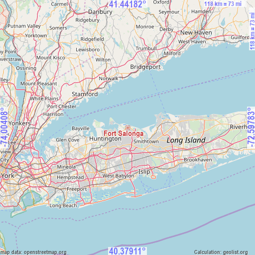
Fort Salonga GPS coordinates[2]
40° 54' 45.36" North, 73° 18' 3.42" West
| Map corner | latitude | longitude |
|---|---|---|
| Upper-left | 41.44182°, | -74.00408° |
| Center: | 40.9126°, | -73.30095° |
| Lower-right: | 40.37911°, | -72.59783° |
| Map W x H: | 118.2×118.2 km | = 73.4×73.4mi |
| max Lat: | 71.29058° ⇑35.1% North |
| Fort Salonga: | 40.9126° |
| min Lat: | ⇓64.9% South 19.06759° |
| min Long | Fort Salonga | max Long |
| -171.73463° | -73.30095° | -66.98998° |
| W 93.2%⇐ | ⇒6.8% E |
Elevation
Elevation of Fort Salonga is 11 m = 36 ft, and this is 283.8 m = 931 ft below average elevation for this country.
| Max E: |
3189 m = 10463 ft | 93% |
| Avg. | 294.8 m = 967 ft | |
| Fort Salonga | 11 m = 36 ft | |
Min E: |
-60 m = -197 ft | 7% |
See also: United States elevation on elevation.city.
Geographical zone
Fort Salonga is located in North temperate zone (between Tropic of Cancer and the Arctic Circle). Distance of this Northern Tropic circle is 1943.1 km =1207.4 mi to South.| Distance of | km | miles | from Fort Salonga |
|---|---|---|---|
| North Pole | 5458 | 3391.4 | to North |
| Arctic Circle | 2852.1 | 1772.2 | to North |
| Tropic Cancer | 1943.1 | 1207.4 | to South |
| Equator | 4549.1 | 2826.7 | to South |


Nearby cities:
15 places around Fort Salonga: (largest is in red/bold)
• Asharoken
5.2 km =3.2 mi,  288°
288°
• Centerport
7 km =4.3 mi,  244°
244°
• Commack
7.8 km =4.8 mi,  175°
175°
• East Northport
4.5 km =2.8 mi,  206°
206°
• Eatons Neck
8.7 km =5.4 mi,  283°
283°
• Elwood
8 km =5 mi,  201°
201°
• Greenlawn
7.3 km =4.5 mi,  228°
228°
• Halesite
10 km =6.2 mi,  254°
254°
• Huntington Bay
9.7 km =6 mi,  261°
261°
• Huntington Station
11.4 km =7.1 mi, 234°
• Kings Park
4.7 km =2.9 mi,  128°
128°
• Nissequogue
8.7 km =5.4 mi,  96°
96°
• Northport
3.8 km =2.4 mi, 249°
• Smithtown
10.5 km =6.5 mi, 126°
• Village of the Branch
11.4 km =7.1 mi,  123°
123°
Sources, notices
• [Note1] Compared only with cities in United States existing in our database
• [Src1] Map data: © OpenStreetMap contributors (CC-BY-SA)
• [Src2] Other city data from geonames.org with taken over terms of usage.
• [Src3] Geographical zone / Annual Mean Temperature by Robert A. Rohde @ Wikipedia
