Hampton Bays geodata
Hampton Bays (New York) is a populated place; located in United States in America/New_York (GMT-4) time zone. With population of 13,603 people, there are 3533 cities with bigger population in this country. Compared to other cities in United States, 64.3% of cities are located further ↓South; 94.8% of cities are located further ←West and 90.5% of cities have higher elevation than Hampton Bays. Note1


Hampton Bays GPS coordinates[2]
40° 52' 8.364" North, 72° 31' 3.324" West
| Map corner | latitude | longitude |
|---|---|---|
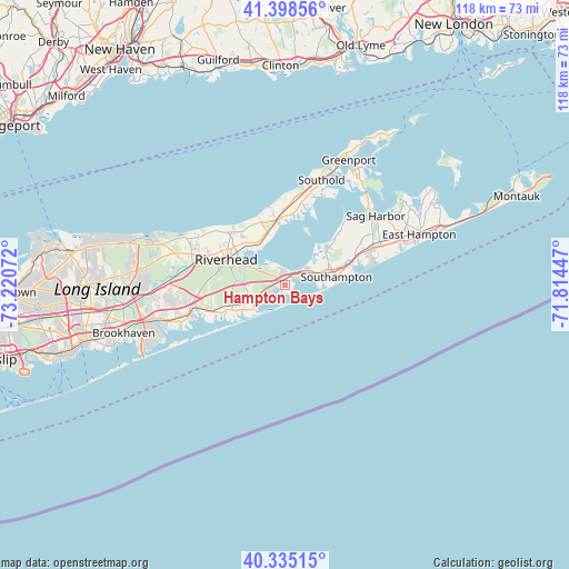
| Upper-left | 41.39856°, | -73.22072° |
| Center: | 40.86899°, | -72.51759° |
| Lower-right: | 40.33515°, | -71.81447° |
| Map W x H: | 118.2×118.2 km | = 73.4×73.4mi |
| max Lat: | 71.29058° ⇑35.7% North |
| Hampton Bays: | 40.86899° |
| min Lat: | ⇓64.3% South 19.06759° |
| min Long | Hampton Bays | max Long |
| -171.73463° | -72.51759° | -66.98998° |
| W 94.8%⇐ | ⇒5.2% E |
Elevation
Elevation of Hampton Bays is 15 m = 49 ft, and this is 279.8 m = 918 ft below average elevation for this country.
| Max E: |
3189 m = 10463 ft | 90.5% |
| Avg. | 294.8 m = 967 ft | |
| Hampton Bays | 15 m = 49 ft | |
Min E: |
-60 m = -197 ft | 9.5% |
See also: United States elevation on elevation.city.
Geographical zone
Hampton Bays is located in North temperate zone (between Tropic of Cancer and the Arctic Circle). Distance of this Northern Tropic circle is 1938.3 km =1204.4 mi to South.| Distance of | km | miles | from Hampton Bays |
|---|---|---|---|
| North Pole | 5462.9 | 3394.5 | to North |
| Arctic Circle | 2857 | 1775.3 | to North |
| Tropic Cancer | 1938.3 | 1204.4 | to South |
| Equator | 4544.2 | 2823.6 | to South |


Nearby cities:
15 places around Hampton Bays: (largest is in red/bold)
• Aquebogue
12.5 km =7.8 mi,  312°
312°
• East Quogue
6.2 km =3.9 mi,  239°
239°
• Flanders
9.2 km =5.7 mi,  294°
294°
• Jamesport
10.4 km =6.5 mi,  329°
329°
• Laurel
11.8 km =7.3 mi,  341°
341°
• North Sea
11.2 km =7 mi,  50°
50°
• Quiogue
10.8 km =6.7 mi, 239°
• Quogue
9.3 km =5.8 mi, 236°
• Riverhead
13.3 km =8.3 mi, 293°
• Riverside
13.5 km =8.4 mi,  275°
275°
• Shinnecock Hills
5.1 km =3.2 mi,  61°
61°
• Southampton
10.9 km =6.8 mi,  81°
81°
• Tuckahoe
9.6 km =6 mi,  69°
69°
• Westhampton
13.4 km =8.3 mi,  248°
248°
• Westhampton Beach
11 km =6.8 mi,  228°
228°
Sources, notices
• [Note1] Compared only with cities in United States existing in our database
• [Src1] Map data: © OpenStreetMap contributors (CC-BY-SA)
• [Src2] Other city data from geonames.org with taken over terms of usage.
• [Src3] Geographical zone / Annual Mean Temperature by Robert A. Rohde @ Wikipedia
