Lake Luzerne geodata
Lake Luzerne (New York) is a populated place; located in United States in America/New_York (GMT-4) time zone. With population of 1,227 people, there are 14971 cities with bigger population in this country. Compared to other cities in United States, 85.4% of cities are located further ↓South; 91.5% of cities are located further ←West and 56.9% of cities have higher elevation than Lake Luzerne. Note1


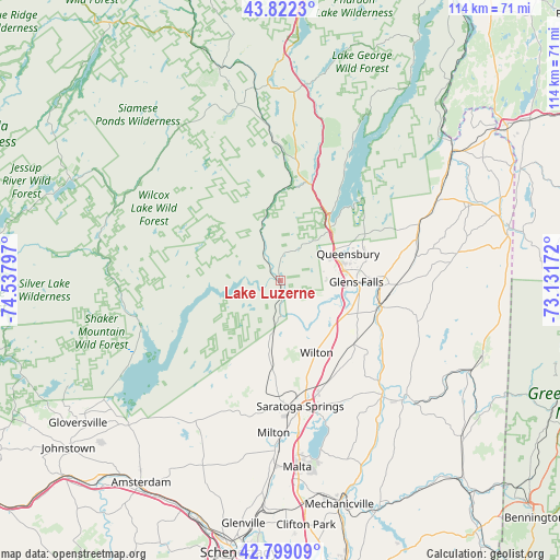
Lake Luzerne GPS coordinates[2]
43° 18' 46.26" North, 73° 50' 5.424" West
| Map corner | latitude | longitude |
|---|---|---|
| Upper-left | 43.8223°, | -74.53797° |
| Center: | 43.31285°, | -73.83484° |
| Lower-right: | 42.79909°, | -73.13172° |
| Map W x H: | 113.8×113.8 km | = 70.7×70.7mi |
| max Lat: | 71.29058° ⇑14.6% North |
| Lake Luzerne: | 43.31285° |
| min Lat: | ⇓85.4% South 19.06759° |
| min Long | Lake Luzerne | max Long |
| -171.73463° | -73.83484° | -66.98998° |
| W 91.5%⇐ | ⇒8.5% E |
Elevation
Elevation of Lake Luzerne is 171 m = 561 ft, and this is 123.8 m = 406 ft below average elevation for this country.
| Max E: |
3189 m = 10463 ft | 56.9% |
| Avg. | 294.8 m = 967 ft | |
| Lake Luzerne | 171 m = 561 ft | |
Min E: |
-60 m = -197 ft | 43.1% |
See also: United States elevation on elevation.city.
Geographical zone
Lake Luzerne is located in North temperate zone (between Tropic of Cancer and the Arctic Circle). Distance of this Northern Tropic circle is 2210 km =1373.2 mi to South.| Distance of | km | miles | from Lake Luzerne |
|---|---|---|---|
| North Pole | 5191.1 | 3225.6 | to North |
| Arctic Circle | 2585.2 | 1606.4 | to North |
| Tropic Cancer | 2210 | 1373.2 | to South |
| Equator | 4815.9 | 2992.5 | to South |


Nearby cities:
15 places around Lake Luzerne: (largest is in red/bold)
• Corinth
7.6 km =4.7 mi,  178°
178°
• Edinburg
24 km =14.9 mi,  245°
245°
• Fort Edward
20.9 km =13 mi,  104°
104°
• Glens Falls
15.4 km =9.6 mi,  91°
91°
• Glens Falls North
12.6 km =7.8 mi,  78°
78°
• Hadley
1.2 km =0.7 mi,  294°
294°
• Hudson Falls
20.2 km =12.6 mi, 93°
• Lake George
16 km =9.9 mi,  38°
38°
• Northumberland
28.7 km =17.8 mi,  135°
135°
• Northville
29 km =18 mi, 250°
• Queensbury
19.3 km =12 mi,  68°
68°
• Saratoga Springs
25.9 km =16.1 mi,  170°
170°
• South Glens Falls
16.2 km =10.1 mi, 95°
• Warrensburg
21 km =13 mi,  13°
13°
• West Glens Falls
12.3 km =7.6 mi, 96°
Sources, notices
• [Note1] Compared only with cities in United States existing in our database
• [Src1] Map data: © OpenStreetMap contributors (CC-BY-SA)
• [Src2] Other city data from geonames.org with taken over terms of usage.
• [Src3] Geographical zone / Annual Mean Temperature by Robert A. Rohde @ Wikipedia
