Victory Mills geodata
Victory Mills (New York) is a populated place; located in United States in America/New_York (GMT-4) time zone. With population of 621 people, there are 19457 cities with bigger population in this country. Compared to other cities in United States, 84% of cities are located further ↓South; 92.6% of cities are located further ←West and 76.5% of cities have higher elevation than Victory Mills. Note1


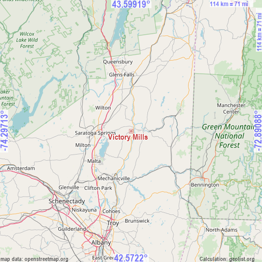
Victory Mills GPS coordinates[2]
43° 5' 16.26" North, 73° 35' 38.4" West
| Map corner | latitude | longitude |
|---|---|---|
| Upper-left | 43.59919°, | -74.29713° |
| Center: | 43.08785°, | -73.594° |
| Lower-right: | 42.5722°, | -72.89088° |
| Map W x H: | 114.2×114.2 km | = 71×71mi |
| max Lat: | 71.29058° ⇑16% North |
| Victory Mills: | 43.08785° |
| min Lat: | ⇓84% South 19.06759° |
| min Long | Victory Mills | max Long |
| -171.73463° | -73.594° | -66.98998° |
| W 92.6%⇐ | ⇒7.4% E |
Elevation
Elevation of Victory Mills is 63 m = 207 ft, and this is 231.8 m = 760 ft below average elevation for this country.
| Max E: |
3189 m = 10463 ft | 76.5% |
| Avg. | 294.8 m = 967 ft | |
| Victory Mills | 63 m = 207 ft | |
Min E: |
-60 m = -197 ft | 23.5% |
See also: United States elevation on elevation.city.
Geographical zone
Victory Mills is located in North temperate zone (between Tropic of Cancer and the Arctic Circle). Distance of this Northern Tropic circle is 2185 km =1357.7 mi to South.| Distance of | km | miles | from Victory Mills |
|---|---|---|---|
| North Pole | 5216.1 | 3241.1 | to North |
| Arctic Circle | 2610.3 | 1622 | to North |
| Tropic Cancer | 2185 | 1357.7 | to South |
| Equator | 4790.9 | 2976.9 | to South |


Nearby cities:
15 places around Victory Mills: (largest is in red/bold)
• Ballston Spa
22.9 km =14.2 mi,  244°
244°
• Cambridge
18.5 km =11.5 mi,  111°
111°
• Fort Edward
19.9 km =12.4 mi,  2°
2°
• Greenwich
7.7 km =4.8 mi,  87°
87°
• Hudson Falls
23.7 km =14.7 mi, 1°
• Mechanicville
21.9 km =13.6 mi,  200°
200°
• Milton
21.9 km =13.6 mi,  254°
254°
• North Ballston Spa
22.2 km =13.8 mi, 250°
• Northumberland
4.4 km =2.7 mi,  6°
6°
• Round Lake
23 km =14.3 mi,  223°
223°
• Salem
23.6 km =14.7 mi,  66°
66°
• Saratoga Springs
15.5 km =9.6 mi,  268°
268°
• Schaghticoke
20.9 km =13 mi,  178°
178°
• Schuylerville
1.7 km =1.1 mi,  36°
36°
• Stillwater
17.3 km =10.7 mi, 196°
Sources, notices
• [Note1] Compared only with cities in United States existing in our database
• [Src1] Map data: © OpenStreetMap contributors (CC-BY-SA)
• [Src2] Other city data from geonames.org with taken over terms of usage.
• [Src3] Geographical zone / Annual Mean Temperature by Robert A. Rohde @ Wikipedia
