Sugarcreek geodata
Sugarcreek (Ohio) is a populated place; located in United States in America/New_York (GMT-4) time zone. With population of 2,234 people, there are 11262 cities with bigger population in this country. Compared to other cities in United States, 59% of cities are located further ↓South; 66.9% of cities are located further ←West and 73.6% of cities have lower elevation than Sugarcreek. Note1
Administrative division(s):
- Level 1: Ohio
- Level 2: Tuscarawas County
- Level 3: Township of Sugar Creek


Sugarcreek GPS coordinates[2]
40° 30' 11.232" North, 81° 38' 27.456" West
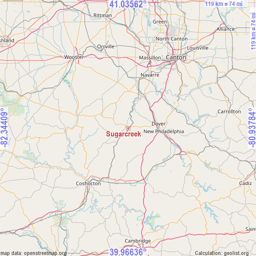
| Map corner | latitude | longitude |
|---|---|---|
| Upper-left | 41.03562°, | -82.34409° |
| Center: | 40.50312°, | -81.64096° |
| Lower-right: | 39.96636°, | -80.93784° |
| Map W x H: | 118.9×118.9 km | = 73.9×73.9mi |
| max Lat: | 71.29058° ⇑41% North |
| Sugarcreek: | 40.50312° |
| min Lat: | ⇓59% South 19.06759° |
| min Long | Sugarcreek | max Long |
| -171.73463° | -81.64096° | -66.98998° |
| W 66.9%⇐ | ⇒33.1% E |
Elevation
Elevation of Sugarcreek is 305 m = 1001 ft, and this is 10.2 m = 33 ft above average elevation for this country.
| Max E: |
3189 m = 10463 ft | 26.4% |
| Sugarcreek | 305 m 1001 ft | |
| Avg. | 294.8 m = 967 ft | |
Min E: |
-60 m = -197 ft | 73.6% |
See also: United States elevation on elevation.city.
Geographical zone
Sugarcreek is located in North temperate zone (between Tropic of Cancer and the Arctic Circle). Distance of this Northern Tropic circle is 1897.6 km =1179.1 mi to South.| Distance of | km | miles | from Sugarcreek |
|---|---|---|---|
| North Pole | 5503.5 | 3419.7 | to North |
| Arctic Circle | 2897.6 | 1800.5 | to North |
| Tropic Cancer | 1897.6 | 1179.1 | to South |
| Equator | 4503.5 | 2798.3 | to South |


Nearby cities:
15 places around Sugarcreek: (largest is in red/bold)
• Baltic
8.6 km =5.3 mi,  215°
215°
• Beach City
17.4 km =10.8 mi,  16°
16°
• Berlin
14.5 km =9 mi,  296°
296°
• Bolivar
22.8 km =14.2 mi,  44°
44°
• Brewster
23 km =14.3 mi,  9°
9°
• Dover
14.2 km =8.8 mi,  82°
82°
• Gnadenhutten
23.8 km =14.8 mi,  132°
132°
• Midvale
23.8 km =14.8 mi,  107°
107°
• Millersburg
24.1 km =15 mi,  283°
283°
• New Philadelphia
16.6 km =10.3 mi,  95°
95°
• Port Washington
22 km =13.7 mi,  152°
152°
• Strasburg
14 km =8.7 mi, 43°
• Sugarcreek Police Dept
0.1 km =0.1 mi,  225°
225°
• Tuscarawas
23.2 km =14.4 mi,  121°
121°
• Walnut Creek
8.1 km =5 mi, 301°
Sources, notices
• [Note1] Compared only with cities in United States existing in our database
• [Src1] Map data: © OpenStreetMap contributors (CC-BY-SA)
• [Src2] Other city data from geonames.org with taken over terms of usage.
• [Src3] Geographical zone / Annual Mean Temperature by Robert A. Rohde @ Wikipedia
