Bairdford geodata
Bairdford (Pennsylvania) is a populated place; located in United States in America/New_York (GMT-4) time zone. With population of 698 people, there are 18696 cities with bigger population in this country. Compared to other cities in United States, 60.5% of cities are located further ↓South; 73.8% of cities are located further ←West and 78.2% of cities have lower elevation than Bairdford. Note1
Administrative division(s):
- Level 1: Pennsylvania
- Level 2: Allegheny County
- Level 3: Township of West Deer


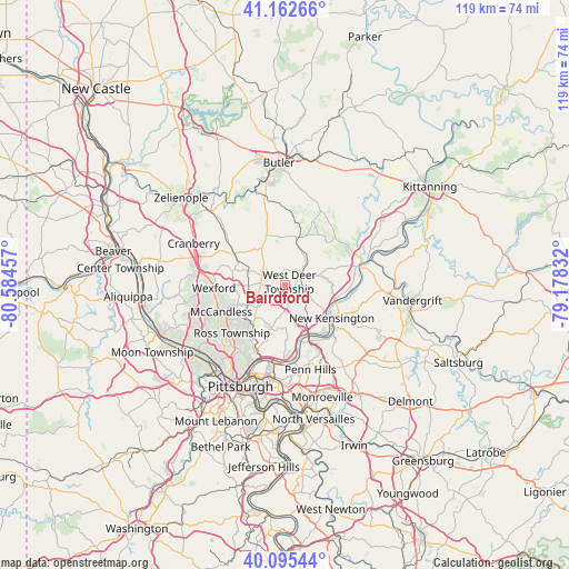
Bairdford GPS coordinates[2]
40° 37' 52.248" North, 79° 52' 53.184" West
| Map corner | latitude | longitude |
|---|---|---|
| Upper-left | 41.16266°, | -80.58457° |
| Center: | 40.63118°, | -79.88144° |
| Lower-right: | 40.09544°, | -79.17832° |
| Map W x H: | 118.7×118.7 km | = 73.8×73.8mi |
| max Lat: | 71.29058° ⇑39.5% North |
| Bairdford: | 40.63118° |
| min Lat: | ⇓60.5% South 19.06759° |
| min Long | Bairdford | max Long |
| -171.73463° | -79.88144° | -66.98998° |
| W 73.8%⇐ | ⇒26.2% E |
Elevation
Elevation of Bairdford is 337 m = 1106 ft, and this is 42.2 m = 138 ft above average elevation for this country.
| Max E: |
3189 m = 10463 ft | 21.8% |
| Bairdford | 337 m 1106 ft | |
| Avg. | 294.8 m = 967 ft | |
Min E: |
-60 m = -197 ft | 78.2% |
See also: United States elevation on elevation.city.
Geographical zone
Bairdford is located in North temperate zone (between Tropic of Cancer and the Arctic Circle). Distance of this Northern Tropic circle is 1911.8 km =1187.9 mi to South.| Distance of | km | miles | from Bairdford |
|---|---|---|---|
| North Pole | 5489.3 | 3410.9 | to North |
| Arctic Circle | 2883.4 | 1791.7 | to North |
| Tropic Cancer | 1911.8 | 1187.9 | to South |
| Equator | 4517.8 | 2807.2 | to South |


Nearby cities:
15 places around Bairdford: (largest is in red/bold)
• Allison Park
10.3 km =6.4 mi,  219°
219°
• Arnold
11.2 km =7 mi,  120°
120°
• Bakerstown
5.1 km =3.2 mi,  295°
295°
• Brackenridge
12.1 km =7.5 mi,  102°
102°
• Cheswick
12.1 km =7.5 mi,  145°
145°
• Curtisville
2.9 km =1.8 mi,  64°
64°
• Fox Chapel
13.1 km =8.1 mi,  179°
179°
• Gibsonia
7.4 km =4.6 mi,  269°
269°
• Harwick
10.5 km =6.5 mi,  142°
142°
• New Kensington
12 km =7.5 mi, 124°
• Oakmont
12.6 km =7.8 mi,  164°
164°
• Russellton
4.3 km =2.7 mi, 120°
• Springdale
13 km =8.1 mi, 140°
• Tarentum
10.8 km =6.7 mi,  107°
107°
• Valencia
10.3 km =6.4 mi, 298°
Sources, notices
• [Note1] Compared only with cities in United States existing in our database
• [Src1] Map data: © OpenStreetMap contributors (CC-BY-SA)
• [Src2] Other city data from geonames.org with taken over terms of usage.
• [Src3] Geographical zone / Annual Mean Temperature by Robert A. Rohde @ Wikipedia
