Elverson geodata
Elverson (Pennsylvania) is a populated place; located in United States in America/New_York (GMT-4) time zone. With population of 1,314 people, there are 14529 cities with bigger population in this country. Compared to other cities in United States, 55.1% of cities are located further ↓South; 84.6% of cities are located further ←West and 52.8% of cities have lower elevation than Elverson. Note1
Administrative division(s):
- Level 1: Pennsylvania
- Level 2: Chester County
- Level 3: Borough of Elverson


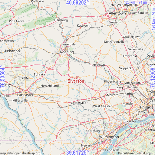
Elverson GPS coordinates[2]
40° 9' 24.336" North, 75° 49' 57.756" West
| Map corner | latitude | longitude |
|---|---|---|
| Upper-left | 40.69202°, | -76.53584° |
| Center: | 40.15676°, | -75.83271° |
| Lower-right: | 39.61725°, | -75.12959° |
| Map W x H: | 119.5×119.5 km | = 74.3×74.3mi |
| max Lat: | 71.29058° ⇑44.9% North |
| Elverson: | 40.15676° |
| min Lat: | ⇓55.1% South 19.06759° |
| min Long | Elverson | max Long |
| -171.73463° | -75.83271° | -66.98998° |
| W 84.6%⇐ | ⇒15.4% E |
Elevation
Elevation of Elverson is 209 m = 686 ft, and this is 85.8 m = 281 ft below average elevation for this country.
| Max E: |
3189 m = 10463 ft | 47.2% |
| Avg. | 294.8 m = 967 ft | |
| Elverson | 209 m = 686 ft | |
Min E: |
-60 m = -197 ft | 52.8% |
See also: United States elevation on elevation.city.
Geographical zone
Elverson is located in North temperate zone (between Tropic of Cancer and the Arctic Circle). Distance of this Northern Tropic circle is 1859.1 km =1155.2 mi to South.| Distance of | km | miles | from Elverson |
|---|---|---|---|
| North Pole | 5542 | 3443.6 | to North |
| Arctic Circle | 2936.2 | 1824.5 | to North |
| Tropic Cancer | 1859.1 | 1155.2 | to South |
| Equator | 4465 | 2774.4 | to South |


Nearby cities:
15 places around Elverson: (largest is in red/bold)
• Alleghenyville
15.8 km =9.8 mi,  303°
303°
• Amity Gardens
15.5 km =9.6 mi,  32°
32°
• Birdsboro
12.2 km =7.6 mi,  11°
11°
• Bowmansville
16.3 km =10.1 mi,  285°
285°
• Eagleview
16.9 km =10.5 mi,  129°
129°
• East Earl
17.8 km =11.1 mi,  253°
253°
• Flying Hills
15 km =9.3 mi,  332°
332°
• Gibraltar
14.6 km =9.1 mi,  346°
346°
• Grill
18.2 km =11.3 mi, 329°
• Honey Brook
9.6 km =6 mi,  223°
223°
• Lorane
14.8 km =9.2 mi, 352°
• Morgantown
4.9 km =3 mi,  267°
267°
• Pottstown
18.4 km =11.4 mi,  57°
57°
• South Pottstown
18 km =11.2 mi, 59°
• Stowe
17 km =10.6 mi,  51°
51°
Sources, notices
• [Note1] Compared only with cities in United States existing in our database
• [Src1] Map data: © OpenStreetMap contributors (CC-BY-SA)
• [Src2] Other city data from geonames.org with taken over terms of usage.
• [Src3] Geographical zone / Annual Mean Temperature by Robert A. Rohde @ Wikipedia
