Frizzleburg geodata
Frizzleburg (Pennsylvania) is a populated place; located in United States in America/New_York (GMT-4) time zone. With population of 602 people, there are 19678 cities with bigger population in this country. Compared to other cities in United States, 66.6% of cities are located further ↓South; 71% of cities are located further ←West and 76.6% of cities have lower elevation than Frizzleburg. Note1
Administrative division(s):
- Level 1: Pennsylvania
- Level 2: Lawrence County
- Level 3: Township of Pulaski


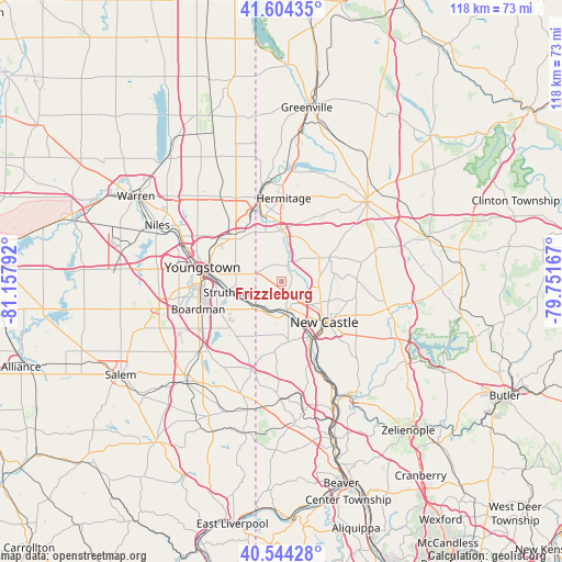
Frizzleburg GPS coordinates[2]
41° 4' 35.22" North, 80° 27' 17.244" West
| Map corner | latitude | longitude |
|---|---|---|
| Upper-left | 41.60435°, | -81.15792° |
| Center: | 41.07645°, | -80.45479° |
| Lower-right: | 40.54428°, | -79.75167° |
| Map W x H: | 117.9×117.9 km | = 73.3×73.3mi |
| max Lat: | 71.29058° ⇑33.4% North |
| Frizzleburg: | 41.07645° |
| min Lat: | ⇓66.6% South 19.06759° |
| min Long | Frizzleburg | max Long |
| -171.73463° | -80.45479° | -66.98998° |
| W 71%⇐ | ⇒29% E |
Elevation
Elevation of Frizzleburg is 325 m = 1066 ft, and this is 30.2 m = 99 ft above average elevation for this country.
| Max E: |
3189 m = 10463 ft | 23.4% |
| Frizzleburg | 325 m 1066 ft | |
| Avg. | 294.8 m = 967 ft | |
Min E: |
-60 m = -197 ft | 76.6% |
See also: United States elevation on elevation.city.
Geographical zone
Frizzleburg is located in North temperate zone (between Tropic of Cancer and the Arctic Circle). Distance of this Northern Tropic circle is 1961.4 km =1218.8 mi to South.| Distance of | km | miles | from Frizzleburg |
|---|---|---|---|
| North Pole | 5439.8 | 3380.1 | to North |
| Arctic Circle | 2833.9 | 1760.9 | to North |
| Tropic Cancer | 1961.4 | 1218.8 | to South |
| Equator | 4567.3 | 2838 | to South |


Nearby cities:
15 places around Frizzleburg: (largest is in red/bold)
• Bessemer
11.8 km =7.3 mi,  196°
196°
• Campbell
12.1 km =7.5 mi,  271°
271°
• Hubbard
13.1 km =8.1 mi,  312°
312°
• Lowellville
8.2 km =5.1 mi,  236°
236°
• New Bedford
4.8 km =3 mi,  298°
298°
• New Castle
12.1 km =7.5 mi,  131°
131°
• New Castle Northwest
10.2 km =6.3 mi, 126°
• New Wilmington
11.4 km =7.1 mi,  63°
63°
• Oakland
12 km =7.5 mi,  143°
143°
• Oakwood
9.7 km =6 mi, 139°
• Poland
14.6 km =9.1 mi,  246°
246°
• South New Castle
14.3 km =8.9 mi, 139°
• Struthers
13.1 km =8.1 mi,  258°
258°
• West Middlesex
10.9 km =6.8 mi,  0°
0°
• Wheatland
14.3 km =8.9 mi,  345°
345°
Sources, notices
• [Note1] Compared only with cities in United States existing in our database
• [Src1] Map data: © OpenStreetMap contributors (CC-BY-SA)
• [Src2] Other city data from geonames.org with taken over terms of usage.
• [Src3] Geographical zone / Annual Mean Temperature by Robert A. Rohde @ Wikipedia
