Imperial geodata
Imperial (Pennsylvania) is a populated place; located in United States in America/New_York (GMT-4) time zone. With population of 2,541 people, there are 10515 cities with bigger population in this country. Compared to other cities in United States, 58.5% of cities are located further ↓South; 71.9% of cities are located further ←West and 73.8% of cities have lower elevation than Imperial. Note1
Administrative division(s):
- Level 1: Pennsylvania
- Level 2: Allegheny County
- Level 3: Township of North Fayette


Imperial GPS coordinates[2]
40° 26' 58.236" North, 80° 14' 40.2" West
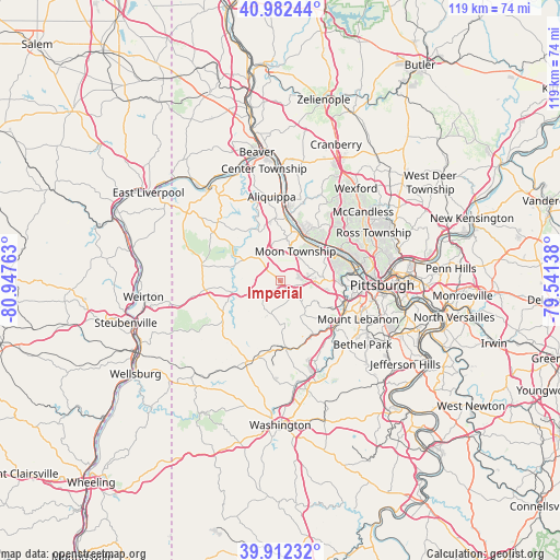
| Map corner | latitude | longitude |
|---|---|---|
| Upper-left | 40.98244°, | -80.94763° |
| Center: | 40.44951°, | -80.2445° |
| Lower-right: | 39.91232°, | -79.54138° |
| Map W x H: | 119×119 km | = 73.9×73.9mi |
| max Lat: | 71.29058° ⇑41.5% North |
| Imperial: | 40.44951° |
| min Lat: | ⇓58.5% South 19.06759° |
| min Long | Imperial | max Long |
| -171.73463° | -80.2445° | -66.98998° |
| W 71.9%⇐ | ⇒28.1% E |
Elevation
Elevation of Imperial is 306 m = 1004 ft, and this is 11.2 m = 37 ft above average elevation for this country.
| Max E: |
3189 m = 10463 ft | 26.2% |
| Imperial | 306 m 1004 ft | |
| Avg. | 294.8 m = 967 ft | |
Min E: |
-60 m = -197 ft | 73.8% |
See also: United States elevation on elevation.city.
Geographical zone
Imperial is located in North temperate zone (between Tropic of Cancer and the Arctic Circle). Distance of this Northern Tropic circle is 1891.6 km =1175.4 mi to South.| Distance of | km | miles | from Imperial |
|---|---|---|---|
| North Pole | 5509.5 | 3423.4 | to North |
| Arctic Circle | 2903.6 | 1804.2 | to North |
| Tropic Cancer | 1891.6 | 1175.4 | to South |
| Equator | 4497.6 | 2794.7 | to South |


Nearby cities:
15 places around Imperial: (largest is in red/bold)
• Carnot-Moon
8 km =5 mi,  16°
16°
• Coraopolis
10.1 km =6.3 mi,  40°
40°
• Edgeworth
12.1 km =7.5 mi, 21°
• Enlow
1.1 km =0.7 mi,  61°
61°
• Joffre
12.5 km =7.8 mi,  231°
231°
• Leetsdale
13 km =8.1 mi,  13°
13°
• McDonald
8.8 km =5.5 mi,  174°
174°
• Midway
9.8 km =6.1 mi,  204°
204°
• Noblestown
7.6 km =4.7 mi,  149°
149°
• Oakdale
7.6 km =4.7 mi,  138°
138°
• Osborne
11.2 km =7 mi,  34°
34°
• Pennsbury Village
12.4 km =7.7 mi,  101°
101°
• Rennerdale
10.4 km =6.5 mi,  123°
123°
• Sewickley
10.9 km =6.8 mi, 27°
• Sturgeon
7.7 km =4.8 mi,  158°
158°
Sources, notices
• [Note1] Compared only with cities in United States existing in our database
• [Src1] Map data: © OpenStreetMap contributors (CC-BY-SA)
• [Src2] Other city data from geonames.org with taken over terms of usage.
• [Src3] Geographical zone / Annual Mean Temperature by Robert A. Rohde @ Wikipedia
