Johnsonburg geodata
Johnsonburg (Pennsylvania) is a populated place; located in United States in America/New_York (GMT-4) time zone. With population of 2,818 people, there are 9965 cities with bigger population in this country. Compared to other cities in United States, 64.5% of cities are located further ↓South; 76.1% of cities are located further ←West and 89.1% of cities have lower elevation than Johnsonburg. Note1
Administrative division(s):
- Level 1: Pennsylvania
- Level 2: Indiana County
- Level 3: Township of Banks


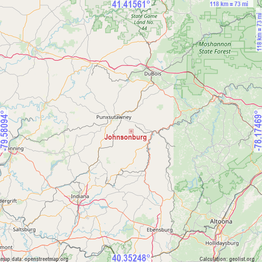
Johnsonburg GPS coordinates[2]
40° 53' 10.248" North, 78° 52' 40.116" West
| Map corner | latitude | longitude |
|---|---|---|
| Upper-left | 41.41561°, | -79.58094° |
| Center: | 40.88618°, | -78.87781° |
| Lower-right: | 40.35248°, | -78.17469° |
| Map W x H: | 118.2×118.2 km | = 73.4×73.4mi |
| max Lat: | 71.29058° ⇑35.5% North |
| Johnsonburg: | 40.88618° |
| min Lat: | ⇓64.5% South 19.06759° |
| min Long | Johnsonburg | max Long |
| -171.73463° | -78.87781° | -66.98998° |
| W 76.1%⇐ | ⇒23.9% E |
Elevation
Elevation of Johnsonburg is 566 m = 1857 ft, and this is 271.2 m = 890 ft above average elevation for this country.
| Max E: |
3189 m = 10463 ft | 10.9% |
| Johnsonburg | 566 m 1857 ft | |
| Avg. | 294.8 m = 967 ft | |
Min E: |
-60 m = -197 ft | 89.1% |
See also: United States elevation on elevation.city.
Geographical zone
Johnsonburg is located in North temperate zone (between Tropic of Cancer and the Arctic Circle). Distance of this Northern Tropic circle is 1940.2 km =1205.6 mi to South.| Distance of | km | miles | from Johnsonburg |
|---|---|---|---|
| North Pole | 5460.9 | 3393.2 | to North |
| Arctic Circle | 2855.1 | 1774.1 | to North |
| Tropic Cancer | 1940.2 | 1205.6 | to South |
| Equator | 4546.1 | 2824.8 | to South |


Nearby cities:
15 places around Johnsonburg: (largest is in red/bold)
• Albion
10 km =6.2 mi,  324°
324°
• Barnesboro
26.2 km =16.3 mi,  161°
161°
• Big Run
9 km =5.6 mi,  359°
359°
• Clymer
26.7 km =16.6 mi,  204°
204°
• DuBois
27.7 km =17.2 mi,  20°
20°
• Falls Creek
29.4 km =18.3 mi,  12°
12°
• Hastings
28.3 km =17.6 mi,  150°
150°
• Northern Cambria
26.5 km =16.5 mi, 162°
• Oklahoma
28.1 km =17.5 mi,  25°
25°
• Punxsutawney
10.1 km =6.3 mi,  309°
309°
• Reynoldsville
23.5 km =14.6 mi, 357°
• Rossiter
4.6 km =2.9 mi,  281°
281°
• Sandy
26.2 km =16.3 mi, 19°
• Spangler
28.5 km =17.7 mi, 161°
• Sykesville
18.8 km =11.7 mi, 14°
Sources, notices
• [Note1] Compared only with cities in United States existing in our database
• [Src1] Map data: © OpenStreetMap contributors (CC-BY-SA)
• [Src2] Other city data from geonames.org with taken over terms of usage.
• [Src3] Geographical zone / Annual Mean Temperature by Robert A. Rohde @ Wikipedia
