Levittown geodata
Levittown (Pennsylvania) is a populated place; located in United States in America/New_York (GMT-4) time zone. With population of 52,983 people, there are 880 cities with bigger population in this country. Compared to other cities in United States, 55.1% of cities are located further ↓South; 87.8% of cities are located further ←West and 91.5% of cities have higher elevation than Levittown. Note1
Administrative division(s):
- Level 1: Pennsylvania
- Level 2: Bucks County
- Level 3: Township of Bristol


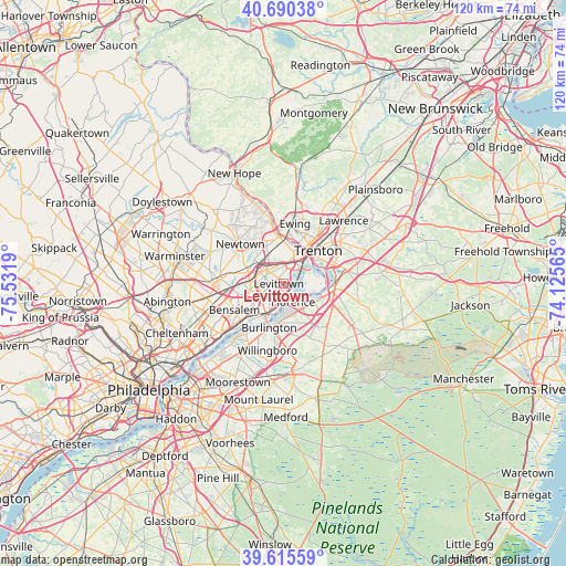
Levittown GPS coordinates[2]
40° 9' 18.396" North, 74° 49' 43.572" West
| Map corner | latitude | longitude |
|---|---|---|
| Upper-left | 40.69038°, | -75.5319° |
| Center: | 40.15511°, | -74.82877° |
| Lower-right: | 39.61559°, | -74.12565° |
| Map W x H: | 119.5×119.5 km | = 74.3×74.3mi |
| max Lat: | 71.29058° ⇑44.9% North |
| Levittown: | 40.15511° |
| min Lat: | ⇓55.1% South 19.06759° |
| min Long | Levittown | max Long |
| -171.73463° | -74.82877° | -66.98998° |
| W 87.8%⇐ | ⇒12.2% E |
Elevation
Elevation of Levittown is 13 m = 43 ft, and this is 281.8 m = 925 ft below average elevation for this country.
| Max E: |
3189 m = 10463 ft | 91.5% |
| Avg. | 294.8 m = 967 ft | |
| Levittown | 13 m = 43 ft | |
Min E: |
-60 m = -197 ft | 8.5% |
See also: Levittown elevation on elevation.city.
Geographical zone
Levittown is located in North temperate zone (between Tropic of Cancer and the Arctic Circle). Distance of this Northern Tropic circle is 1858.9 km =1155.1 mi to South.| Distance of | km | miles | from Levittown |
|---|---|---|---|
| North Pole | 5542.2 | 3443.8 | to North |
| Arctic Circle | 2936.3 | 1824.5 | to North |
| Tropic Cancer | 1858.9 | 1155.1 | to South |
| Equator | 4464.8 | 2774.3 | to South |


Nearby cities:
15 places around Levittown: (largest is in red/bold)
• Bristol
6.4 km =4 mi,  197°
197°
• Burlington
9.8 km =6.1 mi, 198°
• Croydon
9.9 km =6.2 mi,  220°
220°
• Fairless Hills
3.5 km =2.2 mi,  320°
320°
• Fieldsboro
8.7 km =5.4 mi,  103°
103°
• Florence
4.4 km =2.7 mi,  153°
153°
• Hulmeville
7.1 km =4.4 mi,  259°
259°
• Langhorne
8.3 km =5.2 mi,  285°
285°
• Langhorne Manor
7.7 km =4.8 mi,  279°
279°
• Morrisville
7.2 km =4.5 mi,  28°
28°
• Penndel
7.5 km =4.7 mi,  267°
267°
• Roebling
5.7 km =3.5 mi,  140°
140°
• Tullytown
2.1 km =1.3 mi, 145°
• Woodbourne
6.6 km =4.1 mi,  309°
309°
• Woodside
8.4 km =5.2 mi,  331°
331°
Sources, notices
• [Note1] Compared only with cities in United States existing in our database
• [Src1] Map data: © OpenStreetMap contributors (CC-BY-SA)
• [Src2] Other city data from geonames.org with taken over terms of usage.
• [Src3] Geographical zone / Annual Mean Temperature by Robert A. Rohde @ Wikipedia
