Manor geodata
Manor (Pennsylvania) is a populated place; located in United States in America/New_York (GMT-4) time zone. With population of 3,299 people, there are 9149 cities with bigger population in this country. Compared to other cities in United States, 57.1% of cities are located further ↓South; 74.5% of cities are located further ←West and 69.7% of cities have lower elevation than Manor. Note1
Administrative division(s):
- Level 1: Pennsylvania
- Level 2: Westmoreland County
- Level 3: Borough of Manor


Manor GPS coordinates[2]
40° 20' 2.256" North, 79° 40' 12.144" West
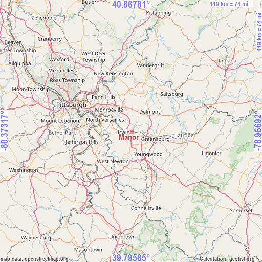
| Map corner | latitude | longitude |
|---|---|---|
| Upper-left | 40.86781°, | -80.37317° |
| Center: | 40.33396°, | -79.67004° |
| Lower-right: | 39.79585°, | -78.96692° |
| Map W x H: | 119.2×119.2 km | = 74.1×74.1mi |
| max Lat: | 71.29058° ⇑42.9% North |
| Manor: | 40.33396° |
| min Lat: | ⇓57.1% South 19.06759° |
| min Long | Manor | max Long |
| -171.73463° | -79.67004° | -66.98998° |
| W 74.5%⇐ | ⇒25.5% E |
Elevation
Elevation of Manor is 284 m = 932 ft, and this is 10.8 m = 35 ft below average elevation for this country.
| Max E: |
3189 m = 10463 ft | 30.3% |
| Avg. | 294.8 m = 967 ft | |
| Manor | 284 m = 932 ft | |
Min E: |
-60 m = -197 ft | 69.7% |
See also: United States elevation on elevation.city.
Geographical zone
Manor is located in North temperate zone (between Tropic of Cancer and the Arctic Circle). Distance of this Northern Tropic circle is 1878.8 km =1167.4 mi to South.| Distance of | km | miles | from Manor |
|---|---|---|---|
| North Pole | 5522.3 | 3431.4 | to North |
| Arctic Circle | 2916.5 | 1812.2 | to North |
| Tropic Cancer | 1878.8 | 1167.4 | to South |
| Equator | 4484.7 | 2786.7 | to South |


Nearby cities:
15 places around Manor: (largest is in red/bold)
• Export
10.1 km =6.3 mi,  21°
21°
• Grapeville
5.5 km =3.4 mi,  99°
99°
• Greenock
11.8 km =7.3 mi,  258°
258°
• Greensburg
11.7 km =7.3 mi,  108°
108°
• Herminie
8.8 km =5.5 mi,  207°
207°
• Irwin
2.8 km =1.7 mi,  248°
248°
• Jeannette
4.7 km =2.9 mi, 97°
• Level Green
7.9 km =4.9 mi,  327°
327°
• Murrysville
10.8 km =6.7 mi,  347°
347°
• North Irwin
3.7 km =2.3 mi,  276°
276°
• Pitcairn
12 km =7.5 mi,  310°
310°
• Southwest Greensburg
11.5 km =7.1 mi, 114°
• Trafford
9.5 km =5.9 mi, 307°
• Wall
11.9 km =7.4 mi,  304°
304°
• White Oak
11.8 km =7.3 mi,  271°
271°
Sources, notices
• [Note1] Compared only with cities in United States existing in our database
• [Src1] Map data: © OpenStreetMap contributors (CC-BY-SA)
• [Src2] Other city data from geonames.org with taken over terms of usage.
• [Src3] Geographical zone / Annual Mean Temperature by Robert A. Rohde @ Wikipedia
