Nittany geodata
Nittany (Pennsylvania) is a populated place; located in United States in America/New_York (GMT-4) time zone. With population of 658 people, there are 19101 cities with bigger population in this country. Compared to other cities in United States, 65.8% of cities are located further ↓South; 78.8% of cities are located further ←West and 68.2% of cities have lower elevation than Nittany. Note1
Administrative division(s):
- Level 1: Pennsylvania
- Level 2: Centre County
- Level 3: Township of Walker


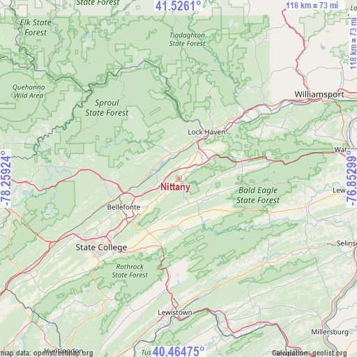
Nittany GPS coordinates[2]
40° 59' 51.216" North, 77° 33' 21.996" West
| Map corner | latitude | longitude |
|---|---|---|
| Upper-left | 41.5261°, | -78.25924° |
| Center: | 40.99756°, | -77.55611° |
| Lower-right: | 40.46475°, | -76.85299° |
| Map W x H: | 118×118 km | = 73.3×73.3mi |
| max Lat: | 71.29058° ⇑34.2% North |
| Nittany: | 40.99756° |
| min Lat: | ⇓65.8% South 19.06759° |
| min Long | Nittany | max Long |
| -171.73463° | -77.55611° | -66.98998° |
| W 78.8%⇐ | ⇒21.2% E |
Elevation
Elevation of Nittany is 277 m = 909 ft, and this is 17.8 m = 58 ft below average elevation for this country.
| Max E: |
3189 m = 10463 ft | 31.8% |
| Avg. | 294.8 m = 967 ft | |
| Nittany | 277 m = 909 ft | |
Min E: |
-60 m = -197 ft | 68.2% |
See also: United States elevation on elevation.city.
Geographical zone
Nittany is located in North temperate zone (between Tropic of Cancer and the Arctic Circle). Distance of this Northern Tropic circle is 1952.6 km =1213.3 mi to South.| Distance of | km | miles | from Nittany |
|---|---|---|---|
| North Pole | 5448.6 | 3385.6 | to North |
| Arctic Circle | 2842.7 | 1766.4 | to North |
| Tropic Cancer | 1952.6 | 1213.3 | to South |
| Equator | 4558.5 | 2832.5 | to South |


Nearby cities:
15 places around Nittany: (largest is in red/bold)
• Aaronsburg
13.9 km =8.6 mi,  141°
141°
• Beech Creek
9.1 km =5.7 mi,  342°
342°
• Blanchard
8.2 km =5.1 mi,  334°
334°
• Castanea
17.7 km =11 mi,  36°
36°
• Centre Hall
19.9 km =12.4 mi,  213°
213°
• Dunnstown
20 km =12.4 mi,  34°
34°
• Flemington
16 km =9.9 mi, 26°
• Howard
8.8 km =5.5 mi,  282°
282°
• Lamar
2.9 km =1.8 mi,  45°
45°
• Lock Haven
18 km =11.2 mi, 30°
• Mill Hall
13.6 km =8.5 mi, 26°
• Millheim
13.6 km =8.5 mi,  150°
150°
• Mingoville
10.6 km =6.6 mi,  226°
226°
• Rote
14.6 km =9.1 mi, 51°
• Zion
14.2 km =8.8 mi, 229°
Sources, notices
• [Note1] Compared only with cities in United States existing in our database
• [Src1] Map data: © OpenStreetMap contributors (CC-BY-SA)
• [Src2] Other city data from geonames.org with taken over terms of usage.
• [Src3] Geographical zone / Annual Mean Temperature by Robert A. Rohde @ Wikipedia
