Rockledge geodata
Rockledge (Pennsylvania) is a populated place; located in United States in America/New_York (GMT-4) time zone. With population of 2,541 people, there are 10515 cities with bigger population in this country. Compared to other cities in United States, 54.3% of cities are located further ↓South; 87% of cities are located further ←West and 74% of cities have higher elevation than Rockledge. Note1
Administrative division(s):
- Level 1: Pennsylvania
- Level 2: Montgomery County
- Level 3: Borough of Rockledge


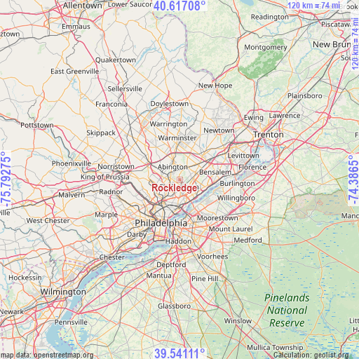
Rockledge GPS coordinates[2]
40° 4' 52.392" North, 75° 5' 22.632" West
| Map corner | latitude | longitude |
|---|---|---|
| Upper-left | 40.61708°, | -75.79275° |
| Center: | 40.08122°, | -75.08962° |
| Lower-right: | 39.54111°, | -74.3865° |
| Map W x H: | 119.6×119.6 km | = 74.3×74.3mi |
| max Lat: | 71.29058° ⇑45.7% North |
| Rockledge: | 40.08122° |
| min Lat: | ⇓54.3% South 19.06759° |
| min Long | Rockledge | max Long |
| -171.73463° | -75.08962° | -66.98998° |
| W 87%⇐ | ⇒13% E |
Elevation
Elevation of Rockledge is 77 m = 253 ft, and this is 217.8 m = 715 ft below average elevation for this country.
| Max E: |
3189 m = 10463 ft | 74% |
| Avg. | 294.8 m = 967 ft | |
| Rockledge | 77 m = 253 ft | |
Min E: |
-60 m = -197 ft | 26% |
See also: United States elevation on elevation.city.
Geographical zone
Rockledge is located in North temperate zone (between Tropic of Cancer and the Arctic Circle). Distance of this Northern Tropic circle is 1850.7 km =1150 mi to South.| Distance of | km | miles | from Rockledge |
|---|---|---|---|
| North Pole | 5550.4 | 3448.9 | to North |
| Arctic Circle | 2944.6 | 1829.7 | to North |
| Tropic Cancer | 1850.7 | 1150 | to South |
| Equator | 4456.6 | 2769.2 | to South |


Nearby cities:
15 places around Rockledge: (largest is in red/bold)
• Bryn Athyn
5.9 km =3.7 mi,  18°
18°
• Dresher
9.3 km =5.8 mi,  315°
315°
• Feasterville
10 km =6.2 mi,  45°
45°
• Flourtown
10.7 km =6.6 mi,  283°
283°
• Glenside
5.8 km =3.6 mi,  293°
293°
• Hatboro
10.5 km =6.5 mi,  351°
351°
• Jenkintown
3.4 km =2.1 mi,  298°
298°
• Oreland
8.6 km =5.3 mi, 298°
• Palmyra
9.8 km =6.1 mi,  147°
147°
• Riverton
10 km =6.2 mi,  140°
140°
• Tacony
6.8 km =4.2 mi, 145°
• Tioga
10.4 km =6.5 mi,  219°
219°
• Willow Grove
7.3 km =4.5 mi,  342°
342°
• Wyncote
5.2 km =3.2 mi, 286°
• Wyndmoor
8.5 km =5.3 mi,  270°
270°
Sources, notices
• [Note1] Compared only with cities in United States existing in our database
• [Src1] Map data: © OpenStreetMap contributors (CC-BY-SA)
• [Src2] Other city data from geonames.org with taken over terms of usage.
• [Src3] Geographical zone / Annual Mean Temperature by Robert A. Rohde @ Wikipedia
