Blue Mounds geodata
Blue Mounds (Wisconsin) is a populated place; located in United States in America/Chicago (GMT-5) time zone. With population of 938 people, there are 16730 cities with bigger population in this country. Compared to other cities in United States, 83.4% of cities are located further ↓South; 58.5% of cities are located further →East and 82.6% of cities have lower elevation than Blue Mounds. Note1


Blue Mounds GPS coordinates[2]
43° 1' 3.828" North, 89° 50' 4.56" West
| Map corner | latitude | longitude |
|---|---|---|
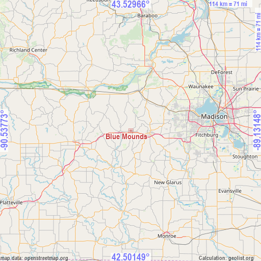
| Upper-left | 43.52966°, | -90.53773° |
| Center: | 43.01773°, | -89.8346° |
| Lower-right: | 42.50149°, | -89.13148° |
| Map W x H: | 114.3×114.3 km | = 71×71mi |
| max Lat: | 71.29058° ⇑16.6% North |
| Blue Mounds: | 43.01773° |
| min Lat: | ⇓83.4% South 19.06759° |
| min Long | Blue Mounds | max Long |
| -171.73463° | -89.8346° | -66.98998° |
| W 41.5%⇐ | ⇒58.5% E |
Elevation
Elevation of Blue Mounds is 383 m = 1257 ft, and this is 88.2 m = 289 ft above average elevation for this country.
| Max E: |
3189 m = 10463 ft | 17.4% |
| Blue Mounds | 383 m 1257 ft | |
| Avg. | 294.8 m = 967 ft | |
Min E: |
-60 m = -197 ft | 82.6% |
See also: United States elevation on elevation.city.
Geographical zone
Blue Mounds is located in North temperate zone (between Tropic of Cancer and the Arctic Circle). Distance of this Northern Tropic circle is 2177.2 km =1352.8 mi to South.| Distance of | km | miles | from Blue Mounds |
|---|---|---|---|
| North Pole | 5223.9 | 3246 | to North |
| Arctic Circle | 2618.1 | 1626.8 | to North |
| Tropic Cancer | 2177.2 | 1352.8 | to South |
| Equator | 4783.1 | 2972.1 | to South |


Nearby cities:
15 places around Blue Mounds: (largest is in red/bold)
• Arena
17.6 km =10.9 mi,  338°
338°
• Barneveld
4.9 km =3 mi,  267°
267°
• Black Earth
15.1 km =9.4 mi,  28°
28°
• Blanchardville
23.2 km =14.4 mi,  185°
185°
• Cross Plains
18.1 km =11.2 mi,  53°
53°
• Dodgeville
24.9 km =15.5 mi,  255°
255°
• Mazomanie
18 km =11.2 mi,  10°
10°
• Middleton
28.3 km =17.6 mi,  71°
71°
• Mount Horeb
7.9 km =4.9 mi,  97°
97°
• New Glarus
27.8 km =17.3 mi,  144°
144°
• Ridgeway
12.8 km =8 mi, 262°
• Roxbury
28.8 km =17.9 mi, 26°
• Spring Green
25.8 km =16 mi,  312°
312°
• Vermont
7.2 km =4.5 mi, 33°
• Verona
24.7 km =15.3 mi, 96°
Sources, notices
• [Note1] Compared only with cities in United States existing in our database
• [Src1] Map data: © OpenStreetMap contributors (CC-BY-SA)
• [Src2] Other city data from geonames.org with taken over terms of usage.
• [Src3] Geographical zone / Annual Mean Temperature by Robert A. Rohde @ Wikipedia
