Weirton Heights geodata
Weirton Heights (West Virginia) is a populated place; located in United States in America/New_York (GMT-4) time zone. With population of 19,450 people, there are 2580 cities with bigger population in this country. Compared to other cities in United States, 58% of cities are located further ↓South; 70.8% of cities are located further ←West and 81% of cities have lower elevation than Weirton Heights. Note1


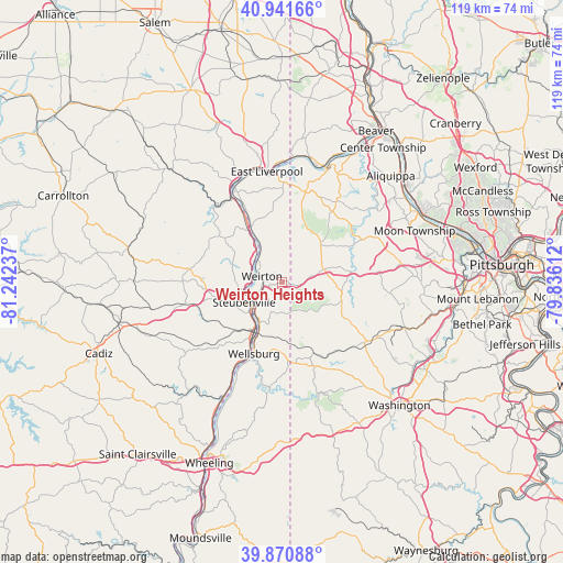
Weirton Heights GPS coordinates[2]
40° 24' 30.24" North, 80° 32' 21.264" West
| Map corner | latitude | longitude |
|---|---|---|
| Upper-left | 40.94166°, | -81.24237° |
| Center: | 40.4084°, | -80.53924° |
| Lower-right: | 39.87088°, | -79.83612° |
| Map W x H: | 119.1×119.1 km | = 74×74mi |
| max Lat: | 71.29058° ⇑42% North |
| Weirton Heights: | 40.4084° |
| min Lat: | ⇓58% South 19.06759° |
| min Long | Weirton Heights | max Long |
| -171.73463° | -80.53924° | -66.98998° |
| W 70.8%⇐ | ⇒29.2% E |
Elevation
Elevation of Weirton Heights is 365 m = 1198 ft, and this is 70.2 m = 230 ft above average elevation for this country.
| Max E: |
3189 m = 10463 ft | 19% |
| Weirton Heights | 365 m 1198 ft | |
| Avg. | 294.8 m = 967 ft | |
Min E: |
-60 m = -197 ft | 81% |
See also: United States elevation on elevation.city.
Geographical zone
Weirton Heights is located in North temperate zone (between Tropic of Cancer and the Arctic Circle). Distance of this Northern Tropic circle is 1887.1 km =1172.6 mi to South.| Distance of | km | miles | from Weirton Heights |
|---|---|---|---|
| North Pole | 5514.1 | 3426.3 | to North |
| Arctic Circle | 2908.2 | 1807.1 | to North |
| Tropic Cancer | 1887.1 | 1172.6 | to South |
| Equator | 4493 | 2791.8 | to South |


Nearby cities:
15 places around Weirton Heights: (largest is in red/bold)
• Avella
16.3 km =10.1 mi,  155°
155°
• Burgettstown
12.7 km =7.9 mi,  103°
103°
• Follansbee
10.2 km =6.3 mi,  208°
208°
• Hooverson Heights
9.8 km =6.1 mi,  199°
199°
• Joffre
15.5 km =9.6 mi, 102°
• Langeloth
11.7 km =7.3 mi,  114°
114°
• Mingo Junction
11.3 km =7 mi, 211°
• New Cumberland
11.4 km =7.1 mi,  329°
329°
• Paris
2.3 km =1.4 mi, 103°
• Slovan
13.8 km =8.6 mi, 113°
• Steubenville
9.1 km =5.7 mi,  241°
241°
• Toronto
8.1 km =5 mi,  319°
319°
• Weirton
4.4 km =2.7 mi,  285°
285°
• Wellsburg
16.3 km =10.1 mi, 201°
• Wintersville
14.4 km =8.9 mi,  255°
255°
Sources, notices
• [Note1] Compared only with cities in United States existing in our database
• [Src1] Map data: © OpenStreetMap contributors (CC-BY-SA)
• [Src2] Other city data from geonames.org with taken over terms of usage.
• [Src3] Geographical zone / Annual Mean Temperature by Robert A. Rohde @ Wikipedia
