East Carbon City geodata
East Carbon City (Utah) is a populated place; located in United States in America/Denver (GMT-6) time zone. With population of 1,270 people, there are 14732 cities with bigger population in this country. Compared to other cities in United States, 50.5% of cities are located further ↑North; 85.9% of cities are located further →East and 98.9% of cities have lower elevation than East Carbon City. Note1


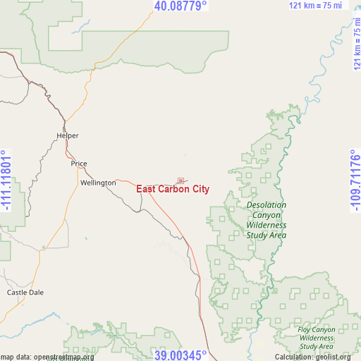
East Carbon City GPS coordinates[2]
39° 32' 51.864" North, 110° 24' 53.568" West
| Map corner | latitude | longitude |
|---|---|---|
| Upper-left | 40.08779°, | -111.11801° |
| Center: | 39.54774°, | -110.41488° |
| Lower-right: | 39.00345°, | -109.71176° |
| Map W x H: | 120.6×120.6 km | = 74.9×74.9mi |
| max Lat: | 71.29058° ⇑50.5% North |
| East Carbon City: | 39.54774° |
| min Lat: | ⇓49.5% South 19.06759° |
| min Long | East Carbon Cit | max Long |
| -171.73463° | -110.41488° | -66.98998° |
| W 14.1%⇐ | ⇒85.9% E |
Elevation
Elevation of East Carbon City is 1926 m = 6319 ft, and this is 1631.2 m = 5352 ft above average elevation for this country.
| Max E: |
3189 m = 10463 ft | 1.1% |
| East Carbon City | 1926 m 6319 ft | |
| Avg. | 294.8 m = 967 ft | |
Min E: |
-60 m = -197 ft | 98.9% |
See also: United States elevation on elevation.city.
Geographical zone
East Carbon City is located in North temperate zone (between Tropic of Cancer and the Arctic Circle). Distance of this Northern Tropic circle is 1791.4 km =1113.1 mi to South.| Distance of | km | miles | from East Carbon City |
|---|---|---|---|
| North Pole | 5609.8 | 3485.8 | to North |
| Arctic Circle | 3003.9 | 1866.5 | to North |
| Tropic Cancer | 1791.4 | 1113.1 | to South |
| Equator | 4397.3 | 2732.4 | to South |


Nearby cities:
15 places around East Carbon City: (largest is in red/bold)
• Carbonville
36.8 km =22.9 mi,  282°
282°
• Castle Dale
64 km =39.8 mi,  234°
234°
• Duchesne
68.5 km =42.6 mi,  0°
0°
• Fairview
88.2 km =54.8 mi, 275°
• Ferron
79.8 km =49.6 mi, 230°
• Green River
65.2 km =40.5 mi,  160°
160°
• Helper
40.6 km =25.2 mi,  291°
291°
• Huntington
53.2 km =33.1 mi,  242°
242°
• Mount Pleasant
89.2 km =55.4 mi,  269°
269°
• Myton
78 km =48.5 mi,  22°
22°
• Orangeville
65.4 km =40.6 mi, 236°
• Price
34.4 km =21.4 mi, 279°
• Spring Glen
39.6 km =24.6 mi, 288°
• Wellington
27.5 km =17.1 mi, 268°
• West Wood
37.2 km =23.1 mi, 279°
Sources, notices
• [Note1] Compared only with cities in United States existing in our database
• [Src1] Map data: © OpenStreetMap contributors (CC-BY-SA)
• [Src2] Other city data from geonames.org with taken over terms of usage.
• [Src3] Geographical zone / Annual Mean Temperature by Robert A. Rohde @ Wikipedia
