Columbia City geodata
Columbia City (Oregon) is a populated place; located in United States in America/Los_Angeles (GMT-7) time zone. With population of 1,958 people, there are 12065 cities with bigger population in this country. Compared to other cities in United States, 94.9% of cities are located further ↓South; 97.5% of cities are located further →East and 90% of cities have higher elevation than Columbia City. Note1


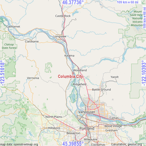
Columbia City GPS coordinates[2]
45° 53' 24.396" North, 122° 48' 25.38" West
| Map corner | latitude | longitude |
|---|---|---|
| Upper-left | 46.37736°, | -123.51018° |
| Center: | 45.89011°, | -122.80705° |
| Lower-right: | 45.39855°, | -122.10393° |
| Map W x H: | 108.8×108.8 km | = 67.6×67.6mi |
| max Lat: | 71.29058° ⇑5.1% North |
| Columbia City: | 45.89011° |
| min Lat: | ⇓94.9% South 19.06759° |
| min Long | Columbia City | max Long |
| -171.73463° | -122.80705° | -66.98998° |
| W 2.5%⇐ | ⇒97.5% E |
Elevation
Elevation of Columbia City is 16 m = 52 ft, and this is 278.8 m = 915 ft below average elevation for this country.
| Max E: |
3189 m = 10463 ft | 90% |
| Avg. | 294.8 m = 967 ft | |
| Columbia City | 16 m = 52 ft | |
Min E: |
-60 m = -197 ft | 10% |
See also: United States elevation on elevation.city.
Geographical zone
Columbia City is located in North temperate zone (between Tropic of Cancer and the Arctic Circle). Distance of this North polar circle is 2298.7 km =1428.3 mi to North.| Distance of | km | miles | from Columbia City |
|---|---|---|---|
| North Pole | 4904.6 | 3047.6 | to North |
| Arctic Circle | 2298.7 | 1428.3 | to North |
| Tropic Cancer | 2496.6 | 1551.3 | to South |
| Equator | 5102.5 | 3170.5 | to South |


Nearby cities:
15 places around Columbia City: (largest is in red/bold)
• Cherry Grove
20.6 km =12.8 mi,  120°
120°
• Dollar Corner
20.2 km =12.6 mi,  127°
127°
• Felida
21.5 km =13.4 mi,  158°
158°
• Kalama
13.5 km =8.4 mi,  347°
347°
• La Center
11 km =6.8 mi,  106°
106°
• Lake Shore
23.9 km =14.9 mi, 157°
• Lewisville
23.7 km =14.7 mi, 112°
• Meadow Glade
24.1 km =15 mi, 127°
• Mount Vista
22 km =13.7 mi,  142°
142°
• Ridgefield
9.7 km =6 mi,  149°
149°
• Saint Helens
2.9 km =1.8 mi,  179°
179°
• Salmon Creek
23.4 km =14.5 mi, 148°
• Scappoose
16.1 km =10 mi,  199°
199°
• Warren
8.5 km =5.3 mi, 202°
• Woodland
5.1 km =3.2 mi,  71°
71°
Sources, notices
• [Note1] Compared only with cities in United States existing in our database
• [Src1] Map data: © OpenStreetMap contributors (CC-BY-SA)
• [Src2] Other city data from geonames.org with taken over terms of usage.
• [Src3] Geographical zone / Annual Mean Temperature by Robert A. Rohde @ Wikipedia
