La Barge geodata
La Barge (Wyoming) is a populated place; located in United States in America/Denver (GMT-6) time zone. With population of 553 people, there are 20244 cities with bigger population in this country. Compared to other cities in United States, 77.9% of cities are located further ↓South; 85.8% of cities are located further →East and 99.2% of cities have lower elevation than La Barge. Note1


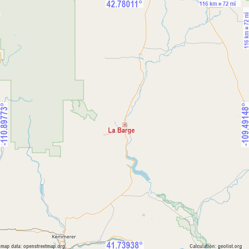
La Barge GPS coordinates[2]
42° 15' 42.804" North, 110° 11' 40.56" West
| Map corner | latitude | longitude |
|---|---|---|
| Upper-left | 42.78011°, | -110.89773° |
| Center: | 42.26189°, | -110.1946° |
| Lower-right: | 41.73938°, | -109.49148° |
| Map W x H: | 115.7×115.7 km | = 71.9×71.9mi |
| max Lat: | 71.29058° ⇑22.1% North |
| La Barge: | 42.26189° |
| min Lat: | ⇓77.9% South 19.06759° |
| min Long | La Barge | max Long |
| -171.73463° | -110.1946° | -66.98998° |
| W 14.2%⇐ | ⇒85.8% E |
Elevation
Elevation of La Barge is 2012 m = 6601 ft, and this is 1717.2 m = 5634 ft above average elevation for this country.
| Max E: |
3189 m = 10463 ft | 0.8% |
| La Barge | 2012 m 6601 ft | |
| Avg. | 294.8 m = 967 ft | |
Min E: |
-60 m = -197 ft | 99.2% |
See also: United States elevation on elevation.city.
Geographical zone
La Barge is located in North temperate zone (between Tropic of Cancer and the Arctic Circle). Distance of this Northern Tropic circle is 2093.2 km =1300.7 mi to South.| Distance of | km | miles | from La Barge |
|---|---|---|---|
| North Pole | 5308 | 3298.2 | to North |
| Arctic Circle | 2702.1 | 1679 | to North |
| Tropic Cancer | 2093.2 | 1300.7 | to South |
| Equator | 4699.1 | 2919.9 | to South |


Nearby cities:
15 places around La Barge: (largest is in red/bold)
• Afton
79.4 km =49.3 mi,  310°
310°
• Big Piney
31.4 km =19.5 mi,  12°
12°
• Cokeville
65.8 km =40.9 mi,  252°
252°
• Diamondville
60.7 km =37.7 mi,  207°
207°
• Garden City
104.9 km =65.2 mi, 250°
• Green River
101.4 km =63 mi,  143°
143°
• James Town
96.5 km =60 mi, 144°
• Kemmerer
59.4 km =36.9 mi, 208°
• Lyman
104.2 km =64.7 mi,  184°
184°
• Marbleton
33.2 km =20.6 mi, 12°
• Montpelier
91 km =56.5 mi,  274°
274°
• North Rock Springs
103.1 km =64.1 mi,  131°
131°
• Paris
99.4 km =61.8 mi, 267°
• Pinedale
72.6 km =45.1 mi,  22°
22°
• Star Valley Ranch
100.5 km =62.4 mi,  321°
321°
Sources, notices
• [Note1] Compared only with cities in United States existing in our database
• [Src1] Map data: © OpenStreetMap contributors (CC-BY-SA)
• [Src2] Other city data from geonames.org with taken over terms of usage.
• [Src3] Geographical zone / Annual Mean Temperature by Robert A. Rohde @ Wikipedia
