‘Ewa Beach geodata
‘Ewa Beach (Hawaii) is a populated place; located in United States in Pacific/Honolulu (GMT-10) time zone. With population of 14,955 people, there are 3250 cities with bigger population in this country. Compared to other cities in United States, 99.7% of cities are located further ↑North; 99.6% of cities are located further →East and 96.6% of cities have higher elevation than ‘Ewa Beach. Note1


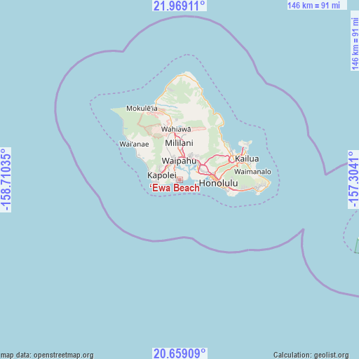
‘Ewa Beach GPS coordinates[2]
21° 18' 56.016" North, 158° 0' 25.992" West
| Map corner | latitude | longitude |
|---|---|---|
| Upper-left | 21.96911°, | -158.71035° |
| Center: | 21.31556°, | -158.00722° |
| Lower-right: | 20.65909°, | -157.3041° |
| Map W x H: | 145.7×145.7 km | = 90.5×90.5mi |
| max Lat: | 71.29058° ⇑99.7% North |
| ‘Ewa Beach: | 21.31556° |
| min Lat: | ⇓0.3% South 19.06759° |
| min Long | ‘Ewa Beach | max Long |
| -171.73463° | -158.00722° | -66.98998° |
| W 0.4%⇐ | ⇒99.6% E |
Elevation
Elevation of ‘Ewa Beach is 7 m = 23 ft, and this is 287.8 m = 944 ft below average elevation for this country.
| Max E: |
3189 m = 10463 ft | 96.6% |
| Avg. | 294.8 m = 967 ft | |
| ‘Ewa Beach | 7 m = 23 ft | |
Min E: |
-60 m = -197 ft | 3.4% |
See also: United States elevation on elevation.city.
Geographical zone
‘Ewa Beach is located in North Torrid zone (between Equator and Tropic of Cancer). Distance of this Northern Tropic circle is 235.9 km =146.6 mi to North.| Distance of | km | miles | from ‘Ewa Beach |
|---|---|---|---|
| North Pole | 7637 | 4745.4 | to North |
| Arctic Circle | 5031.1 | 3126.2 | to North |
| Tropic Cancer | 235.9 | 146.6 | to North |
| Equator | 2370.1 | 1472.7 | to South |


Nearby cities:
15 places around ‘Ewa Beach: (largest is in red/bold)
• Hickam Field
5.6 km =3.5 mi,  61°
61°
• Hālawa
11.4 km =7.1 mi,  51°
51°
• Iroquois Point
2.9 km =1.8 mi, 61°
• Kapolei
5.7 km =3.5 mi,  292°
292°
• Makakilo
9.2 km =5.7 mi,  296°
296°
• Makakilo City
8.9 km =5.5 mi, 293°
• Ocean Pointe
3.1 km =1.9 mi,  259°
259°
• Pearl City
9.7 km =6 mi,  20°
20°
• Royal Kunia
8.9 km =5.5 mi,  346°
346°
• Village Park
9.5 km =5.9 mi, 345°
• Waipahu
7.9 km =4.9 mi,  358°
358°
• Waipio
11.4 km =7.1 mi,  4°
4°
• ‘Aiea
10.6 km =6.6 mi, 45°
• ‘Ewa Gentry
3.6 km =2.2 mi,  318°
318°
• ‘Ewa Villages
4.4 km =2.7 mi,  310°
310°
Sources, notices
• [Note1] Compared only with cities in United States existing in our database
• [Src1] Map data: © OpenStreetMap contributors (CC-BY-SA)
• [Src2] Other city data from geonames.org with taken over terms of usage.
• [Src3] Geographical zone / Annual Mean Temperature by Robert A. Rohde @ Wikipedia
