Ainaloa geodata
Ainaloa (Hawaii) is a populated place; located in United States in Pacific/Honolulu (GMT-10) time zone. With population of 2,965 people, there are 9696 cities with bigger population in this country. Compared to other cities in United States, 99.9% of cities are located further ↑North; 99.2% of cities are located further →East and 55.1% of cities have lower elevation than Ainaloa. Note1


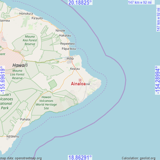
Ainaloa GPS coordinates[2]
19° 31' 36.984" North, 154° 59' 35.016" West
| Map corner | latitude | longitude |
|---|---|---|
| Upper-left | 20.18825°, | -155.69619° |
| Center: | 19.52694°, | -154.99306° |
| Lower-right: | 18.86291°, | -154.28994° |
| Map W x H: | 147.4×147.4 km | = 91.6×91.6mi |
| max Lat: | 71.29058° ⇑99.9% North |
| Ainaloa: | 19.52694° |
| min Lat: | ⇓0.1% South 19.06759° |
| min Long | Ainaloa | max Long |
| -171.73463° | -154.99306° | -66.98998° |
| W 0.8%⇐ | ⇒99.2% E |
Elevation
Elevation of Ainaloa is 219 m = 719 ft, and this is 75.8 m = 249 ft below average elevation for this country.
| Max E: |
3189 m = 10463 ft | 44.9% |
| Avg. | 294.8 m = 967 ft | |
| Ainaloa | 219 m = 719 ft | |
Min E: |
-60 m = -197 ft | 55.1% |
See also: United States elevation on elevation.city.
Geographical zone
Ainaloa is located in North Torrid zone (between Equator and Tropic of Cancer). Distance of this Northern Tropic circle is 434.7 km =270.1 mi to North.| Distance of | km | miles | from Ainaloa |
|---|---|---|---|
| North Pole | 7835.9 | 4869 | to North |
| Arctic Circle | 5230 | 3249.8 | to North |
| Tropic Cancer | 434.7 | 270.1 | to North |
| Equator | 2171.2 | 1349.1 | to South |


Nearby cities:
15 places around Ainaloa: (largest is in red/bold)
• Eden Roc
12.2 km =7.6 mi,  250°
250°
• Fern Acres
9.3 km =5.8 mi,  259°
259°
• Fern Forest
16.4 km =10.2 mi, 245°
• Hawaiian Acres
6.3 km =3.9 mi,  281°
281°
• Hawaiian Beaches
8.3 km =5.2 mi,  77°
77°
• Hawaiian Paradise Park
7.7 km =4.8 mi,  15°
15°
• Hilo
24.8 km =15.4 mi,  335°
335°
• Kea‘au
11.6 km =7.2 mi, 336°
• Kurtistown
10.9 km =6.8 mi,  321°
321°
• Leilani Estates
10.1 km =6.3 mi,  128°
128°
• Mountain View
12.5 km =7.8 mi, 284°
• Nanawale Estates
8.8 km =5.5 mi,  105°
105°
• Orchidlands Estates
4.4 km =2.7 mi,  328°
328°
• Pāhoa
6.3 km =3.9 mi, 125°
• Wainaku
26.5 km =16.5 mi, 336°
Sources, notices
• [Note1] Compared only with cities in United States existing in our database
• [Src1] Map data: © OpenStreetMap contributors (CC-BY-SA)
• [Src2] Other city data from geonames.org with taken over terms of usage.
• [Src3] Geographical zone / Annual Mean Temperature by Robert A. Rohde @ Wikipedia
