Alafaya geodata
Alafaya (Florida) is a populated place; located in United States in America/New_York (GMT-4) time zone. With population of 78,113 people, there are 511 cities with bigger population in this country. Compared to other cities in United States, 95.8% of cities are located further ↑North; 68.8% of cities are located further ←West and 84.1% of cities have higher elevation than Alafaya. Note1


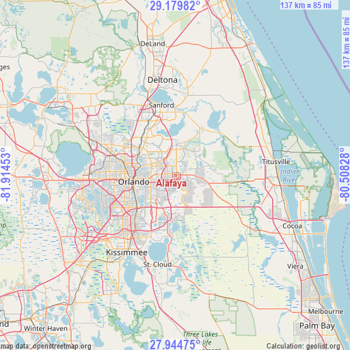
Alafaya GPS coordinates[2]
28° 33' 50.76" North, 81° 12' 41.04" West
| Map corner | latitude | longitude |
|---|---|---|
| Upper-left | 29.17982°, | -81.91453° |
| Center: | 28.5641°, | -81.2114° |
| Lower-right: | 27.94475°, | -80.50828° |
| Map W x H: | 137.3×137.3 km | = 85.3×85.3mi |
| max Lat: | 71.29058° ⇑95.8% North |
| Alafaya: | 28.5641° |
| min Lat: | ⇓4.2% South 19.06759° |
| min Long | Alafaya | max Long |
| -171.73463° | -81.2114° | -66.98998° |
| W 68.8%⇐ | ⇒31.2% E |
Elevation
Elevation of Alafaya is 31 m = 102 ft, and this is 263.8 m = 865 ft below average elevation for this country.
| Max E: |
3189 m = 10463 ft | 84.1% |
| Avg. | 294.8 m = 967 ft | |
| Alafaya | 31 m = 102 ft | |
Min E: |
-60 m = -197 ft | 15.9% |
See also: Alafaya elevation on elevation.city.
Geographical zone
Alafaya is located in North temperate zone (between Tropic of Cancer and the Arctic Circle). Distance of this Northern Tropic circle is 570.1 km =354.2 mi to South.| Distance of | km | miles | from Alafaya |
|---|---|---|---|
| North Pole | 6831 | 4244.6 | to North |
| Arctic Circle | 4225.1 | 2625.4 | to North |
| Tropic Cancer | 570.1 | 354.2 | to South |
| Equator | 3176 | 1973.5 | to South |


Nearby cities:
15 places around Alafaya: (largest is in red/bold)
• Azalea Park
9.1 km =5.7 mi,  253°
253°
• Bithlo
10.3 km =6.4 mi,  95°
95°
• Casselberry
17 km =10.6 mi,  318°
318°
• Chuluota
12.2 km =7.6 mi,  44°
44°
• Conway
13.5 km =8.4 mi,  239°
239°
• Eatonville
17.5 km =10.9 mi,  288°
288°
• Fern Park
16.6 km =10.3 mi,  304°
304°
• Goldenrod
9.1 km =5.7 mi, 304°
• Maitland
16.4 km =10.2 mi, 295°
• Orlando
16.6 km =10.3 mi,  260°
260°
• Oviedo
11.8 km =7.3 mi,  1°
1°
• Union Park
7.3 km =4.5 mi,  273°
273°
• Wedgefield
15.6 km =9.7 mi,  122°
122°
• Winter Park
13.1 km =8.1 mi, 287°
• Winter Springs
17.7 km =11 mi,  327°
327°
Sources, notices
• [Note1] Compared only with cities in United States existing in our database
• [Src1] Map data: © OpenStreetMap contributors (CC-BY-SA)
• [Src2] Other city data from geonames.org with taken over terms of usage.
• [Src3] Geographical zone / Annual Mean Temperature by Robert A. Rohde @ Wikipedia
