Cecil-Bishop geodata
Cecil-Bishop (Pennsylvania) is a populated place; located in United States in America/New_York (GMT-4) time zone. With population of 2,476 people, there are 10683 cities with bigger population in this country. Compared to other cities in United States, 56.9% of cities are located further ↓South; 72.3% of cities are located further ←West and 79.3% of cities have lower elevation than Cecil-Bishop. Note1
Administrative division(s):
- Level 1: Pennsylvania
- Level 2: Washington County
- Level 3: Township of Cecil


Cecil-Bishop GPS coordinates[2]
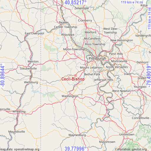
40° 19' 5.484" North, 80° 11' 35.916" West
| Map corner | latitude | longitude |
|---|---|---|
| Upper-left | 40.85217°, | -80.89644° |
| Center: | 40.31819°, | -80.19331° |
| Lower-right: | 39.77996°, | -79.49019° |
| Map W x H: | 119.2×119.2 km | = 74.1×74.1mi |
| max Lat: | 71.29058° ⇑43.1% North |
| Cecil-Bishop: | 40.31819° |
| min Lat: | ⇓56.9% South 19.06759° |
| min Long | Cecil-Bishop | max Long |
| -171.73463° | -80.19331° | -66.98998° |
| W 72.3%⇐ | ⇒27.7% E |
Elevation
Elevation of Cecil-Bishop is 347 m = 1138 ft, and this is 52.2 m = 171 ft above average elevation for this country.
| Max E: |
3189 m = 10463 ft | 20.7% |
| Cecil-Bishop | 347 m 1138 ft | |
| Avg. | 294.8 m = 967 ft | |
Min E: |
-60 m = -197 ft | 79.3% |
See also: United States elevation on elevation.city.
Geographical zone
Cecil-Bishop is located in North temperate zone (between Tropic of Cancer and the Arctic Circle). Distance of this Northern Tropic circle is 1877 km =1166.3 mi to South.| Distance of | km | miles | from Cecil-Bishop |
|---|---|---|---|
| North Pole | 5524.1 | 3432.5 | to North |
| Arctic Circle | 2918.2 | 1813.3 | to North |
| Tropic Cancer | 1877 | 1166.3 | to South |
| Equator | 4483 | 2785.6 | to South |


Nearby cities:
15 places around Cecil-Bishop: (largest is in red/bold)
• Bridgeville
8.2 km =5.1 mi,  59°
59°
• Bryn Mawr
9.2 km =5.7 mi,  99°
99°
• Canonsburg
6.2 km =3.9 mi,  175°
175°
• Hickory
10 km =6.2 mi,  257°
257°
• Houston
8.1 km =5 mi,  190°
190°
• Lawrence
6.3 km =3.9 mi, 102°
• McDonald
6.8 km =4.2 mi,  329°
329°
• Midland
6.9 km =4.3 mi,  197°
197°
• Muse
2.9 km =1.8 mi, 191°
• Noblestown
8.1 km =5 mi,  356°
356°
• Oakdale
8.9 km =5.5 mi,  4°
4°
• Rennerdale
9.9 km =6.2 mi,  26°
26°
• Sturgeon
7.6 km =4.7 mi,  348°
348°
• Thompsonville
7.8 km =4.8 mi,  112°
112°
• Upper Saint Clair
9.5 km =5.9 mi,  78°
78°
Sources, notices
• [Note1] Compared only with cities in United States existing in our database
• [Src1] Map data: © OpenStreetMap contributors (CC-BY-SA)
• [Src2] Other city data from geonames.org with taken over terms of usage.
• [Src3] Geographical zone / Annual Mean Temperature by Robert A. Rohde @ Wikipedia
