Jefferson Valley-Yorktown geodata
Jefferson Valley-Yorktown (New York) is a populated place; located in United States in America/New_York (GMT-4) time zone. With population of 14,142 people, there are 3402 cities with bigger population in this country. Compared to other cities in United States, 69% of cities are located further ↓South; 91.6% of cities are located further ←West and 51% of cities have lower elevation than Jefferson Valley-Yorktown. Note1
Current local time in Jefferson Valley-Yorktown:
09:23 PM, TuesdayDifference from your time zone: hours


Jefferson Valley-Yorktown GPS coordinates[2]
41° 19' 4.692" North, 73° 48' 2.376" West
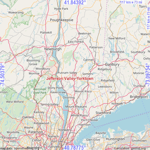
| Map corner | latitude | longitude |
|---|---|---|
| Upper-left | 41.84392°, | -74.50379° |
| Center: | 41.31797°, | -73.80066° |
| Lower-right: | 40.78775°, | -73.09754° |
| Map W x H: | 117.4×117.4 km | = 72.9×72.9mi |
| max Lat: | 71.29058° ⇑31% North |
| Jefferson Valley-Yorktown: | 41.31797° |
| min Lat: | ⇓69% South 19.06759° |
| min Long | Jefferson Valle | max Long |
| -171.73463° | -73.80066° | -66.98998° |
| W 91.6%⇐ | ⇒8.4% E |
Elevation
Elevation of Jefferson Valley-Yorktown is 202 m = 663 ft, and this is 92.8 m = 304 ft below average elevation for this country.
| Max E: |
3189 m = 10463 ft | 49% |
| Avg. | 294.8 m = 967 ft | |
| Jefferson Valley-Yorktown | 202 m = 663 ft | |
Min E: |
-60 m = -197 ft | 51% |
See also: United States elevation on elevation.city.
Geographical zone
Jefferson Valley-Yorktown is located in North temperate zone (between Tropic of Cancer and the Arctic Circle). Distance of this Northern Tropic circle is 1988.2 km =1235.4 mi to South.| Distance of | km | miles | from Jefferson Valley-Yorktown |
|---|---|---|---|
| North Pole | 5412.9 | 3363.4 | to North |
| Arctic Circle | 2807 | 1744.2 | to North |
| Tropic Cancer | 1988.2 | 1235.4 | to South |
| Equator | 4594.1 | 2854.6 | to South |


Nearby cities:
15 places around Jefferson Valley-Yorktown: (largest is in red/bold)
• Bedford Hills
12.7 km =7.9 mi,  135°
135°
• Buchanan
13.1 km =8.1 mi,  241°
241°
• Crompond
6 km =3.7 mi, 244°
• Crugers
13.9 km =8.6 mi,  227°
227°
• Goldens Bridge
10.7 km =6.6 mi,  104°
104°
• Heritage Hills
9 km =5.6 mi,  74°
74°
• Katonah
11.7 km =7.3 mi,  124°
124°
• Lake Mohegan
3.8 km =2.4 mi,  269°
269°
• Lincolndale
6.9 km =4.3 mi,  85°
85°
• Mahopac
8.2 km =5.1 mi,  42°
42°
• Montrose
13.1 km =8.1 mi, 236°
• Peekskill
10.5 km =6.5 mi,  252°
252°
• Shenorock
5.4 km =3.4 mi, 73°
• Shrub Oak
1.9 km =1.2 mi,  304°
304°
• Yorktown Heights
5.6 km =3.5 mi,  159°
159°
Sources, notices
• [Note1] Compared only with cities in United States existing in our database
• [Src1] Map data: © OpenStreetMap contributors (CC-BY-SA)
• [Src2] Other city data from geonames.org with taken over terms of usage.
• [Src3] Geographical zone / Annual Mean Temperature by Robert A. Rohde @ Wikipedia
