Upper Pohatcong geodata
Upper Pohatcong (New Jersey) is a populated place; located in United States in America/New_York (GMT-4) time zone. With population of 1,781 people, there are 12620 cities with bigger population in this country. Compared to other cities in United States, 61.2% of cities are located further ↓South; 86.8% of cities are located further ←West and 70.3% of cities have higher elevation than Upper Pohatcong. Note1
Administrative division(s):
- Level 1: New Jersey
- Level 2: Warren County
- Level 3: Township of Pohatcong


Upper Pohatcong GPS coordinates[2]
40° 40' 38.892" North, 75° 9' 20.88" West
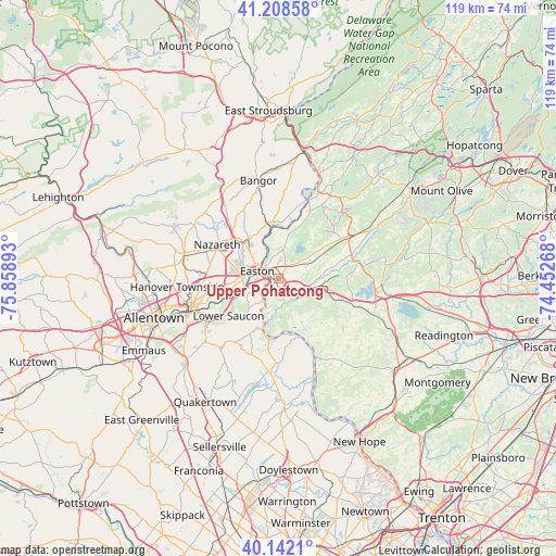
| Map corner | latitude | longitude |
|---|---|---|
| Upper-left | 41.20858°, | -75.85893° |
| Center: | 40.67747°, | -75.1558° |
| Lower-right: | 40.1421°, | -74.45268° |
| Map W x H: | 118.6×118.6 km | = 73.7×73.7mi |
| max Lat: | 71.29058° ⇑38.8% North |
| Upper Pohatcong: | 40.67747° |
| min Lat: | ⇓61.2% South 19.06759° |
| min Long | Upper Pohatcong | max Long |
| -171.73463° | -75.1558° | -66.98998° |
| W 86.8%⇐ | ⇒13.2% E |
Elevation
Elevation of Upper Pohatcong is 99 m = 325 ft, and this is 195.8 m = 642 ft below average elevation for this country.
| Max E: |
3189 m = 10463 ft | 70.3% |
| Avg. | 294.8 m = 967 ft | |
| Upper Pohatcong | 99 m = 325 ft | |
Min E: |
-60 m = -197 ft | 29.7% |
See also: United States elevation on elevation.city.
Geographical zone
Upper Pohatcong is located in North temperate zone (between Tropic of Cancer and the Arctic Circle). Distance of this Northern Tropic circle is 1917 km =1191.2 mi to South.| Distance of | km | miles | from Upper Pohatcong |
|---|---|---|---|
| North Pole | 5484.2 | 3407.7 | to North |
| Arctic Circle | 2878.3 | 1788.5 | to North |
| Tropic Cancer | 1917 | 1191.2 | to South |
| Equator | 4522.9 | 2810.4 | to South |


Nearby cities:
15 places around Upper Pohatcong: (largest is in red/bold)
• Alpha
1.2 km =0.7 mi,  186°
186°
• Bloomsbury
6.4 km =4 mi,  114°
114°
• Easton
5.6 km =3.5 mi,  282°
282°
• Lopatcong Overlook
2.4 km =1.5 mi,  21°
21°
• Martins Creek
12.1 km =7.5 mi,  347°
347°
• Milford
13.1 km =8.1 mi,  156°
156°
• Old Orchard
9.2 km =5.7 mi,  256°
256°
• Palmer Heights
9.1 km =5.7 mi, 276°
• Phillipsburg
3.4 km =2.1 mi,  301°
301°
• Raubsville
5.6 km =3.5 mi,  213°
213°
• Riegelsville
9.8 km =6.1 mi,  199°
199°
• Stockertown
12.4 km =7.7 mi,  313°
313°
• Tatamy
11.1 km =6.9 mi, 309°
• West Easton
6.8 km =4.2 mi,  271°
271°
• Wilson
7.3 km =4.5 mi, 275°
Sources, notices
• [Note1] Compared only with cities in United States existing in our database
• [Src1] Map data: © OpenStreetMap contributors (CC-BY-SA)
• [Src2] Other city data from geonames.org with taken over terms of usage.
• [Src3] Geographical zone / Annual Mean Temperature by Robert A. Rohde @ Wikipedia
