Cranberry Township geodata
Cranberry Township (Pennsylvania) is a populated place; located in United States in America/New_York (GMT-4) time zone. With population of 28,098 people, there are 1776 cities with bigger population in this country. Compared to other cities in United States, 61.3% of cities are located further ↓South; 72.8% of cities are located further ←West and 75.3% of cities have lower elevation than Cranberry Township. Note1
Administrative division(s):
- Level 1: Pennsylvania
- Level 2: Butler County
- Level 3: Township of Cranberry


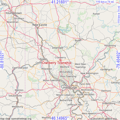
Cranberry Township GPS coordinates[2]
40° 41' 5.856" North, 80° 6' 25.704" West
| Map corner | latitude | longitude |
|---|---|---|
| Upper-left | 41.21601°, | -80.81027° |
| Center: | 40.68496°, | -80.10714° |
| Lower-right: | 40.14965°, | -79.40402° |
| Map W x H: | 118.6×118.6 km | = 73.7×73.7mi |
| max Lat: | 71.29058° ⇑38.7% North |
| Cranberry Township: | 40.68496° |
| min Lat: | ⇓61.3% South 19.06759° |
| min Long | Cranberry Towns | max Long |
| -171.73463° | -80.10714° | -66.98998° |
| W 72.8%⇐ | ⇒27.2% E |
Elevation
Elevation of Cranberry Township is 315 m = 1033 ft, and this is 20.2 m = 66 ft above average elevation for this country.
| Max E: |
3189 m = 10463 ft | 24.7% |
| Cranberry Township | 315 m 1033 ft | |
| Avg. | 294.8 m = 967 ft | |
Min E: |
-60 m = -197 ft | 75.3% |
See also: United States elevation on elevation.city.
Geographical zone
Cranberry Township is located in North temperate zone (between Tropic of Cancer and the Arctic Circle). Distance of this Northern Tropic circle is 1917.8 km =1191.7 mi to South.| Distance of | km | miles | from Cranberry Township |
|---|---|---|---|
| North Pole | 5483.3 | 3407.2 | to North |
| Arctic Circle | 2877.4 | 1787.9 | to North |
| Tropic Cancer | 1917.8 | 1191.7 | to South |
| Equator | 4523.7 | 2810.9 | to South |


Nearby cities:
15 places around Cranberry Township: (largest is in red/bold)
• Aliquippa
12.4 km =7.7 mi,  244°
244°
• Baden
11.6 km =7.2 mi, 241°
• Bell Acres
11.7 km =7.3 mi,  205°
205°
• Bradford Woods
5.7 km =3.5 mi,  157°
157°
• Conway
11.5 km =7.1 mi,  255°
255°
• Evans City
10.1 km =6.3 mi,  21°
21°
• Fernway
2.3 km =1.4 mi,  298°
298°
• Fox Run
2.8 km =1.7 mi,  46°
46°
• Franklin Park
11.4 km =7.1 mi,  171°
171°
• Freedom
12.2 km =7.6 mi,  270°
270°
• Mars
8.1 km =5 mi,  81°
81°
• Seven Fields
3.8 km =2.4 mi, 78°
• Sewickley Hills
11.7 km =7.3 mi,  192°
192°
• Valencia
10 km =6.2 mi,  96°
96°
• Zelienople
12.4 km =7.7 mi,  348°
348°
Sources, notices
• [Note1] Compared only with cities in United States existing in our database
• [Src1] Map data: © OpenStreetMap contributors (CC-BY-SA)
• [Src2] Other city data from geonames.org with taken over terms of usage.
• [Src3] Geographical zone / Annual Mean Temperature by Robert A. Rohde @ Wikipedia
