Charlotte Amalie geodata
Charlotte Amalie (Saint Thomas Island) is a capital of a political entity; located in U.S. Virgin Islands in America/St_Thomas (GMT-4) time zone. With population of 20,000 people, there is 1 city with bigger population in this country. Compared to other cities in U.S. Virgin Islands, 100% of cities are located further ↓South; 100% of cities are located further →East and 100% of cities have higher elevation than Charlotte Amalie. Note1


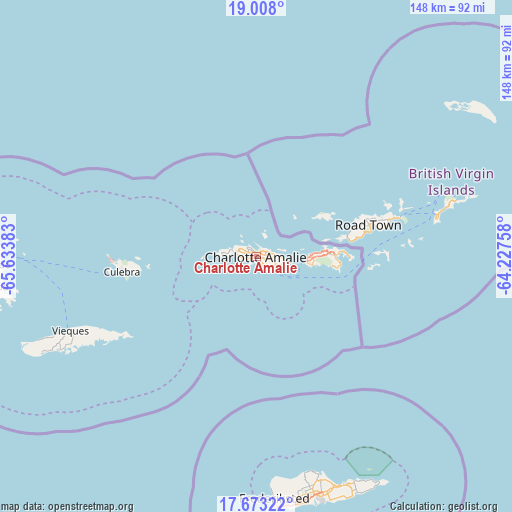
Charlotte Amalie GPS coordinates[2]
18° 20' 30.84" North, 64° 55' 50.52" West
| Map corner | latitude | longitude |
|---|---|---|
| Upper-left | 19.008°, | -65.63383° |
| Center: | 18.3419°, | -64.9307° |
| Lower-right: | 17.67322°, | -64.22758° |
| Map W x H: | 148.4×148.4 km | = 92.2×92.2mi |
| max Lat: | 18.3419° ⇑0% North |
| Charlotte Amalie: | 18.3419° |
| min Lat: | ⇓100% South 17.72751° |
| min Long | Charlotte Amali | max Long |
| -64.9307° | -64.9307° | -64.74698° |
| W 0%⇐ | ⇒100% E |
Elevation
Elevation of Charlotte Amalie is 10 m = 33 ft, and this is 11.7 m = 38 ft below average elevation for this country.
| Max E: |
42 m = 138 ft | 100% |
| Avg. | 21.7 m = 71 ft | |
| Charlotte Amalie | 10 m = 33 ft | |
Min E: |
10 m = 33 ft | 0% |
See also: U.S. Virgin Islands elevation on elevation.city.
Geographical zone
Charlotte Amalie is located in North Torrid zone (between Equator and Tropic of Cancer). Distance of this Northern Tropic circle is 566.5 km =352 mi to North.| Distance of | km | miles | from Charlotte Amalie |
|---|---|---|---|
| North Pole | 7967.6 | 4950.8 | to North |
| Arctic Circle | 5361.7 | 3331.6 | to North |
| Tropic Cancer | 566.5 | 352 | to North |
| Equator | 2039.4 | 1267.2 | to South |


Nearby cities:
2 places around Charlotte Amalie: (largest is in red/bold)
• Cruz Bay
14.5 km =9 mi,  94°
94°
• Saint Croix
71 km =44.1 mi,  164°
164°
In other languages:
- In Spanish: Carlota Amalia
- In Russian: Шарлота Амалия, Шарлотта-Амалия
- In Chinese: 夏洛特阿马利亚
Sources, notices
• [Note1] Compared only with cities in U.S. Virgin Islands existing in our database
• [Src1] Map data: © OpenStreetMap contributors (CC-BY-SA)
• [Src2] Other city data from geonames.org with taken over terms of usage.
• [Src3] Geographical zone / Annual Mean Temperature by Robert A. Rohde @ Wikipedia
